Rounding the bend at the turn around point
April 26, 2014
Trail Run + Kayak + Mtn Bike + BBQ= AWESOMENESS. This is the tagline that drew us into a race comprised of 3 miles trail running, 3 miles flat-water kayaking or 1.5 miles SUP, and 8 miles of mountain biking for the triathlon option. Who wouldn’t be intrigued by the sound of that adventure party? Three fun sports followed by BBQ, is difficult to pass up. Evidently, Adventure Geek Productions has been putting on some form of this race for the last 4 years, but we have never heard anything about it until we stumbled upon it via the internet one evening about 3 weeks before it was due to take place. We were super excited because the distances for this race are not crazy long and it is a unique combination of disciplines for a tri or biathlon.
Once we discovered this event, we immediately tried to talk several different friends and family members into doing it with us, but with only a few weeks notice, there were no takers. Despite our initial excitement, we went back and forth about it for quite a while, halfway training and allowing the signup deadline to creep closer and closer. Finally, with only hours to spare we signed up. David picked the triathlon, because he is a beast in possession of a sweet new-to-him mountain bike, while I opted for the easier biathlon which took out the biking. With some trepidation, we loaded up our gear and headed south, joined by a couple of great friends who agreed to hang out and kindly helped with water, gear etc.
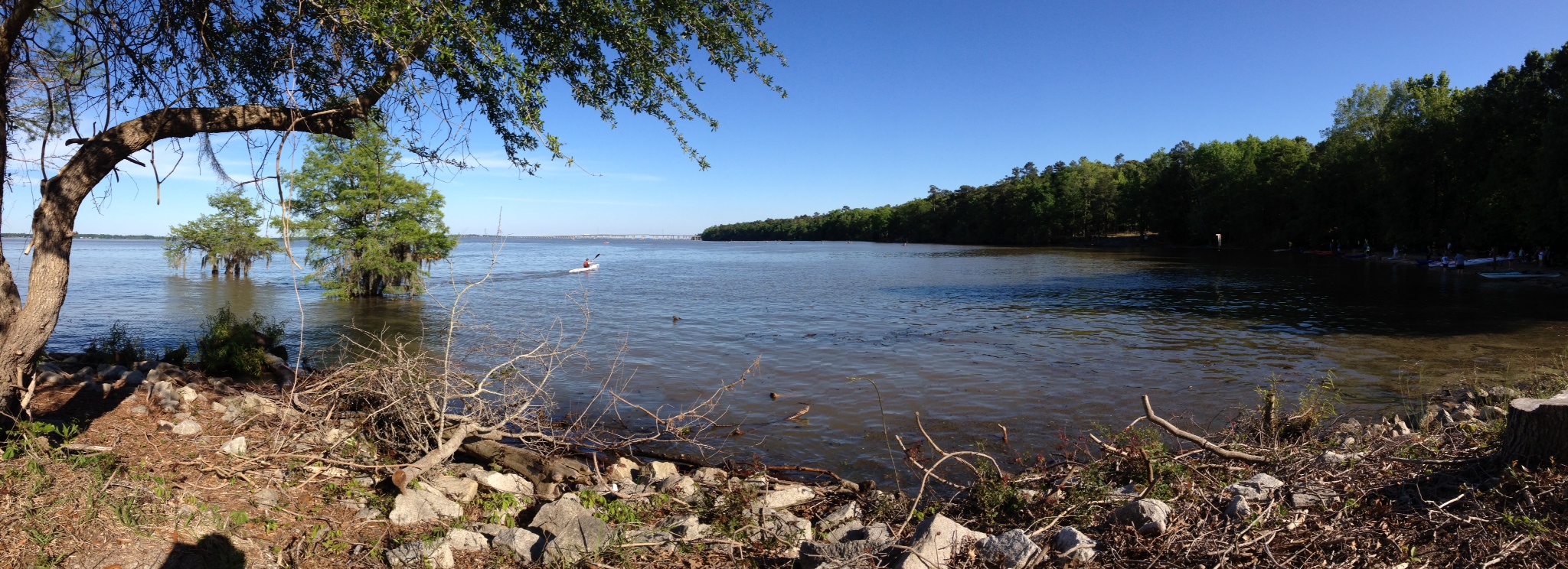
The lakefront course and the beach (photo credit: Garrison Morris)
We arrived about an hour and a half before the race started, checked in and got instructions about where to station our kayaks on the beach. It is a first come, first serve situation for getting your paddling position so we were glad to be there in enough time to have a couple options left. My husband and one of our friends carried the boats down and strategically picked a spot by some very cool racing kayaks. While we were getting situated we met a super nice couple who had done the race multiple times before. They provided some great insider tips about where the run dumped out and the distances between the run finish line and the kayak start. This definitely helped to ease our nerves, but everyone around us looked so hardcore and intense, we still felt like we might get destroyed in each of our respective races.
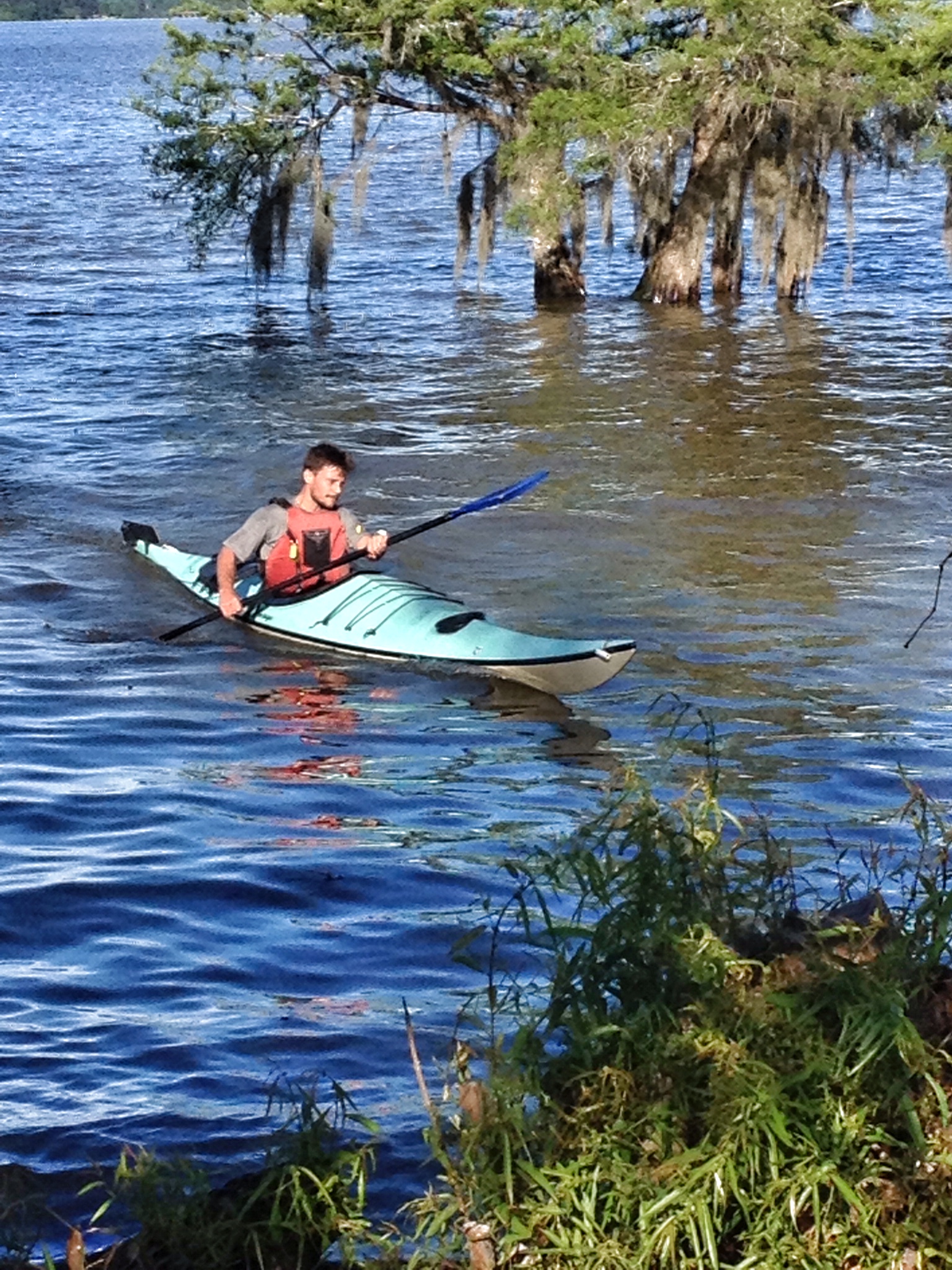
To begin the event, they gathered everyone at the start/finish line and directed us into the woods where we followed red arrows for the run and passed blue arrows that directed mountain bikers during the third leg of the race. The race started almost at a diagonal left, across an open grassy area, past the bike staging zone as well as some picnic spots. That was the only slightly confusing part of the race. We had never run at Santee before, so we didn’t know where the trail was going to begin and as previously stated it wasn’t really a straight shot out of the start line. After we got into the woods, turns were clearly marked, and the course was pretty flat and easy, covered in packed dirt and pine needles. As soon as we hit the finish line our kayak time began. We ran a little more than a quarter of a mile to the boat launch, threw on our pfds, and got launched by the volunteers. The kayak course was two 1.5 mile loops that paralleled the shoreline. If you used an SUP (we did not), you only had to do one loop. Once we finished that, we hopped out of our kayaks as quickly as possible and ran back to the start/finish line. For me, that was the end of the race. David changed shoes, strapped on his helmet and hit the trails again for the 8 mile bike ride. The biking definitely added a significant level of challenge to this event. It wasn’t steep or super technical, according to David, but doing three events over two is definitely more exhausting. Still, we both had very solid finishes. David was 11th overall in the triathlon and I won the much smaller biathlon.

Final pump to the finish
All together, I would heartily recommend this event. It’s a unique challenge to do multiple activities back to back, and we appreciated the fact that this tri/biathlon was off-road and did not involve swimming, a sport we are definitely not in shape for right now. You can rent kayaks through several different outdoor vendors connected to the race which is helpful if you don’t own a boat, and the field of participants is not huge which we found less intimidating. The post-race party atmosphere was great too, with food, plenty of Heed and water, and great camaraderie. If we do it again next year, I would definitely work on my biking and try to do the triathlon, but the biathlon is a great option if you don’t bike. The race can also be run as a team, so grab some friends and start planning for next year’s Santee Surf and Turf Triathlon & Biathlon.
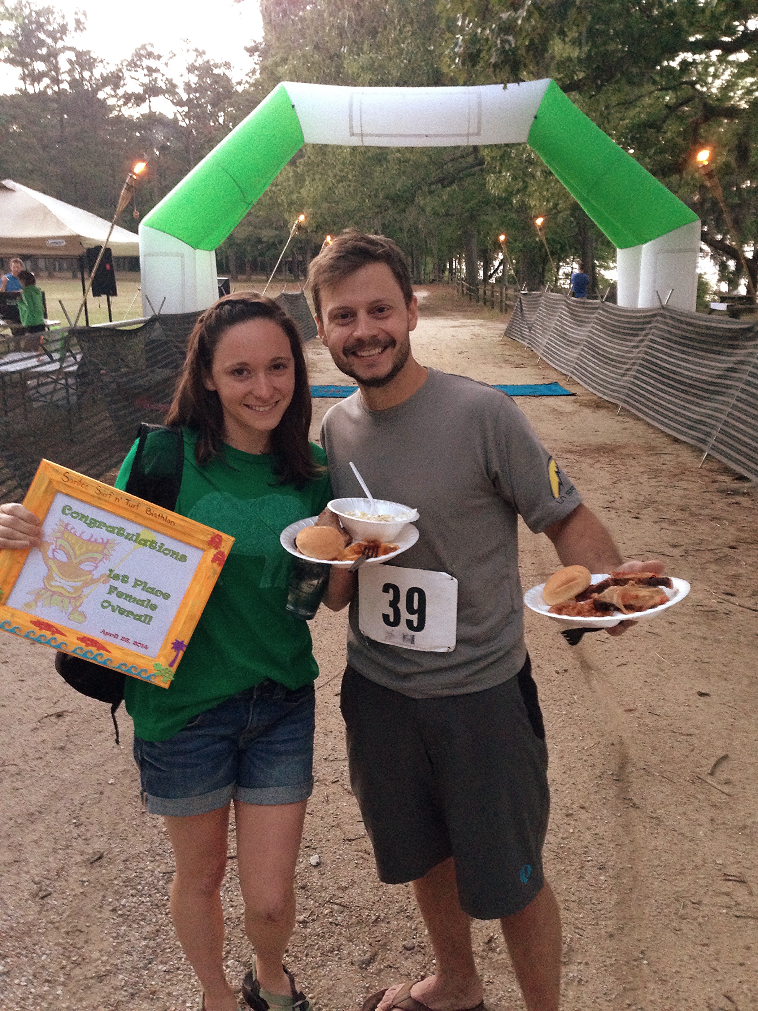
Please note the ample BBQ and the Start/Finish line behind us 🙂
Keep looking for adventure far and nigh!
For more details about this race and other fun events sponsored by Adventure Geek Productions check out this website: http://www.adventuregeekproductions.com/santee-surf-and-turf.html