Appalachian Trail Run : Newfound Gap to the Jump Off and Beyond

IMG_2313

IMG_0596

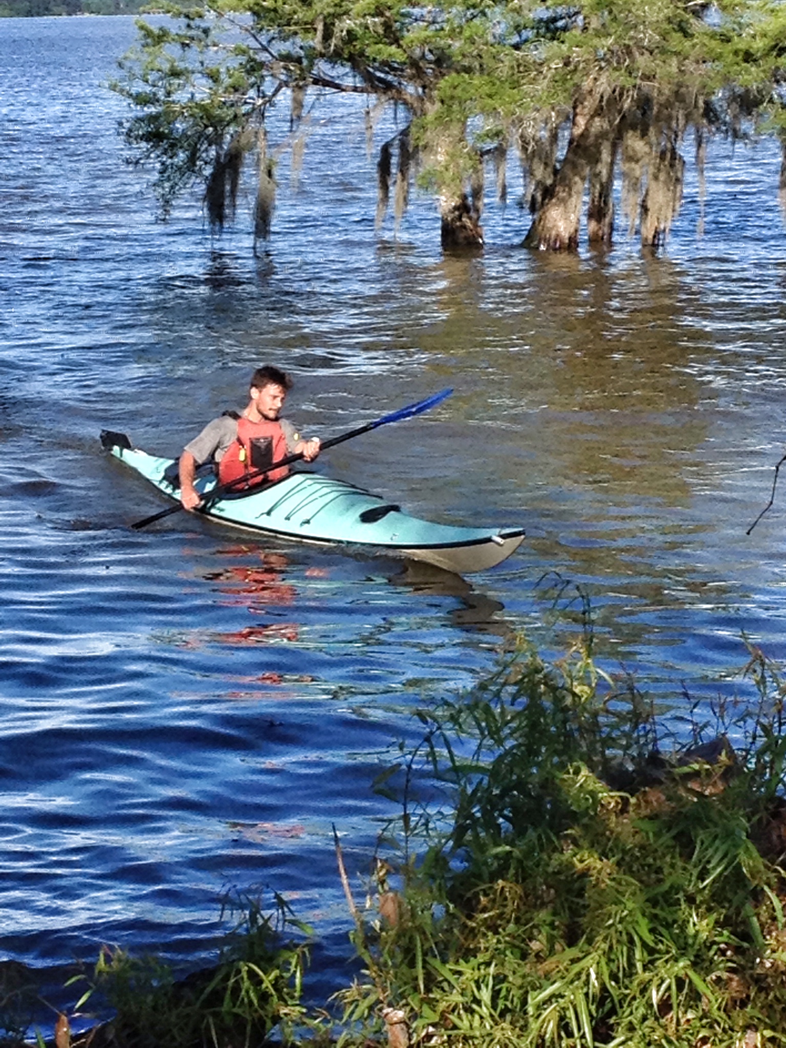
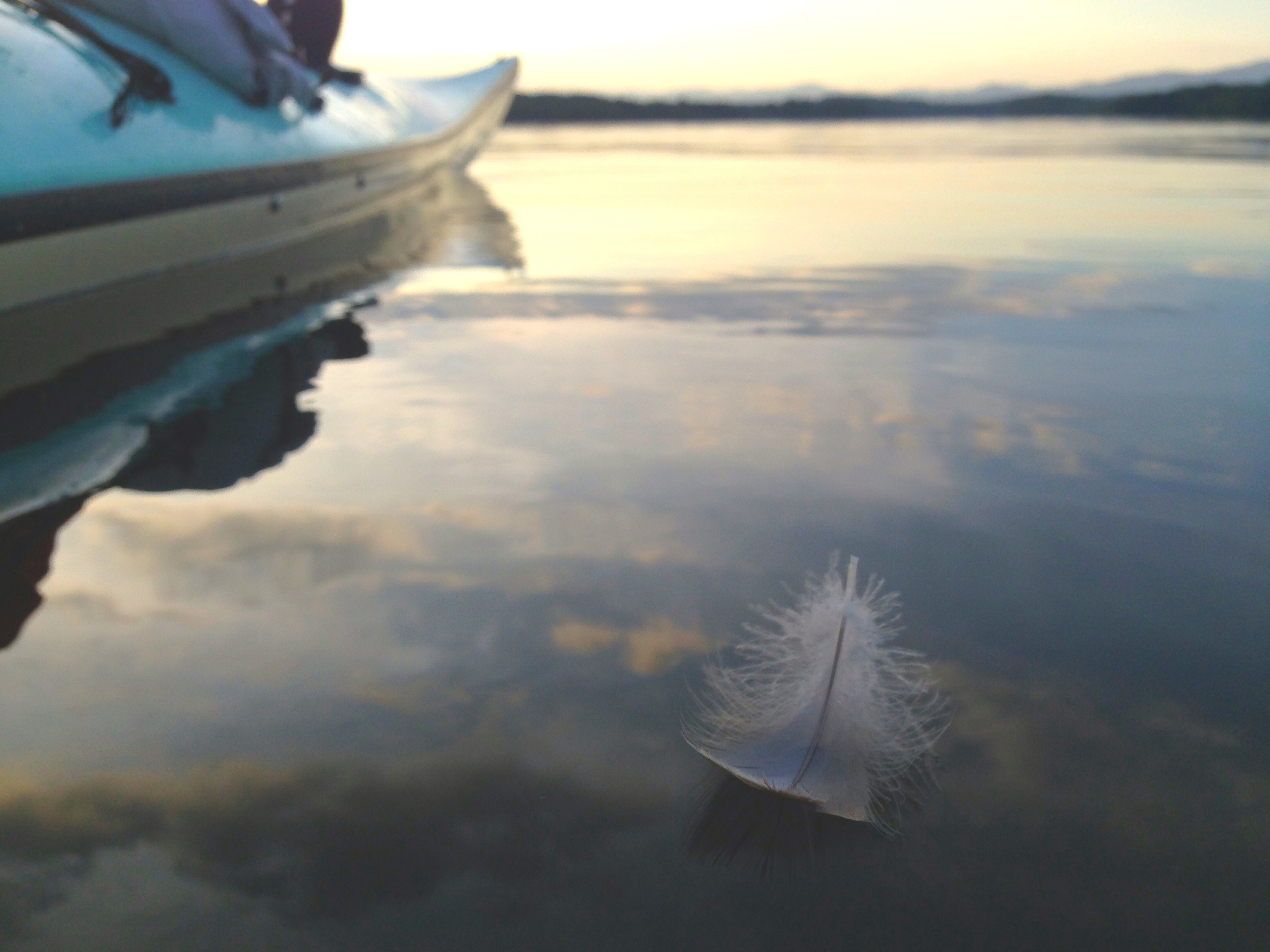
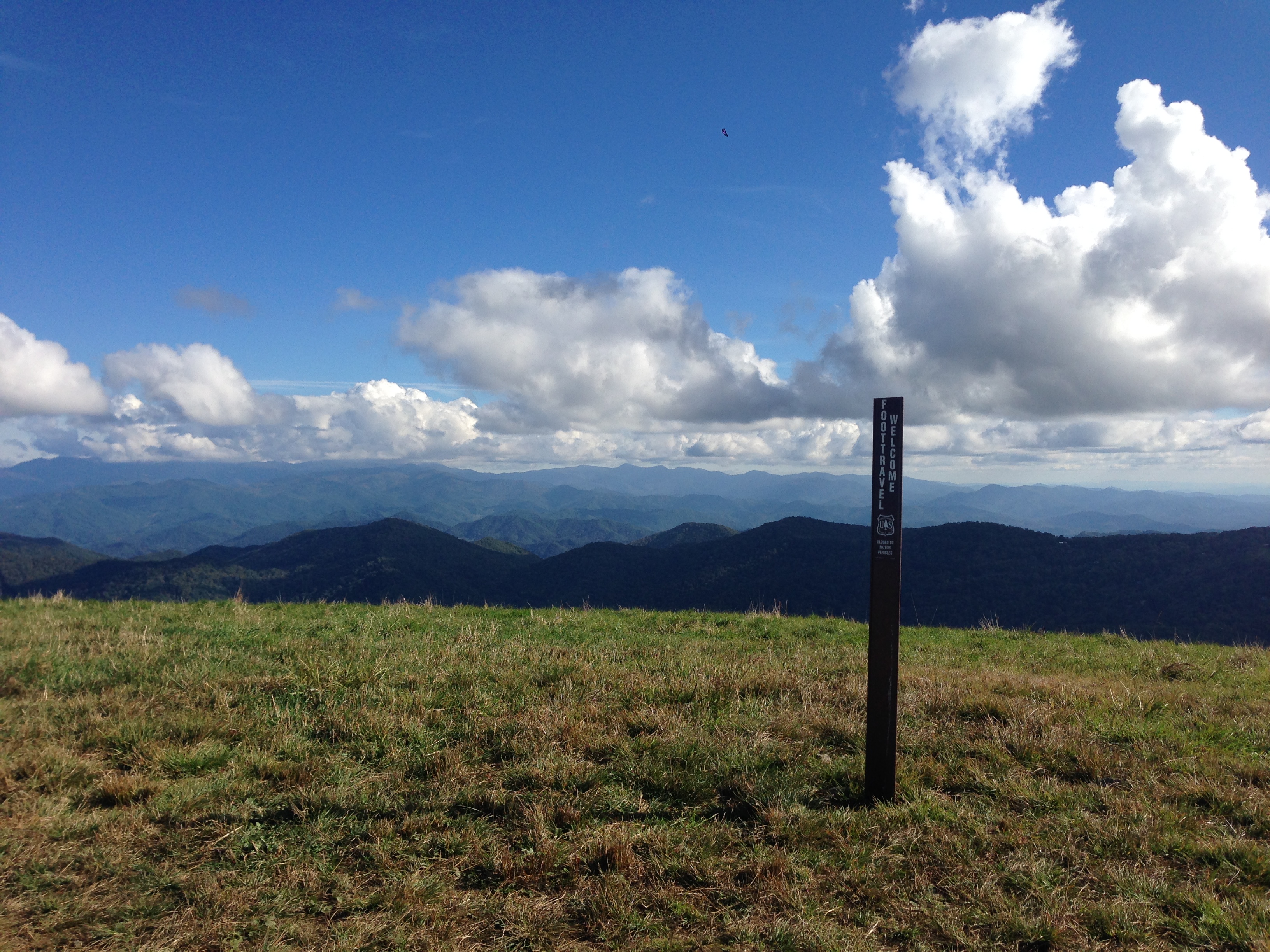
Elk spotting in the park

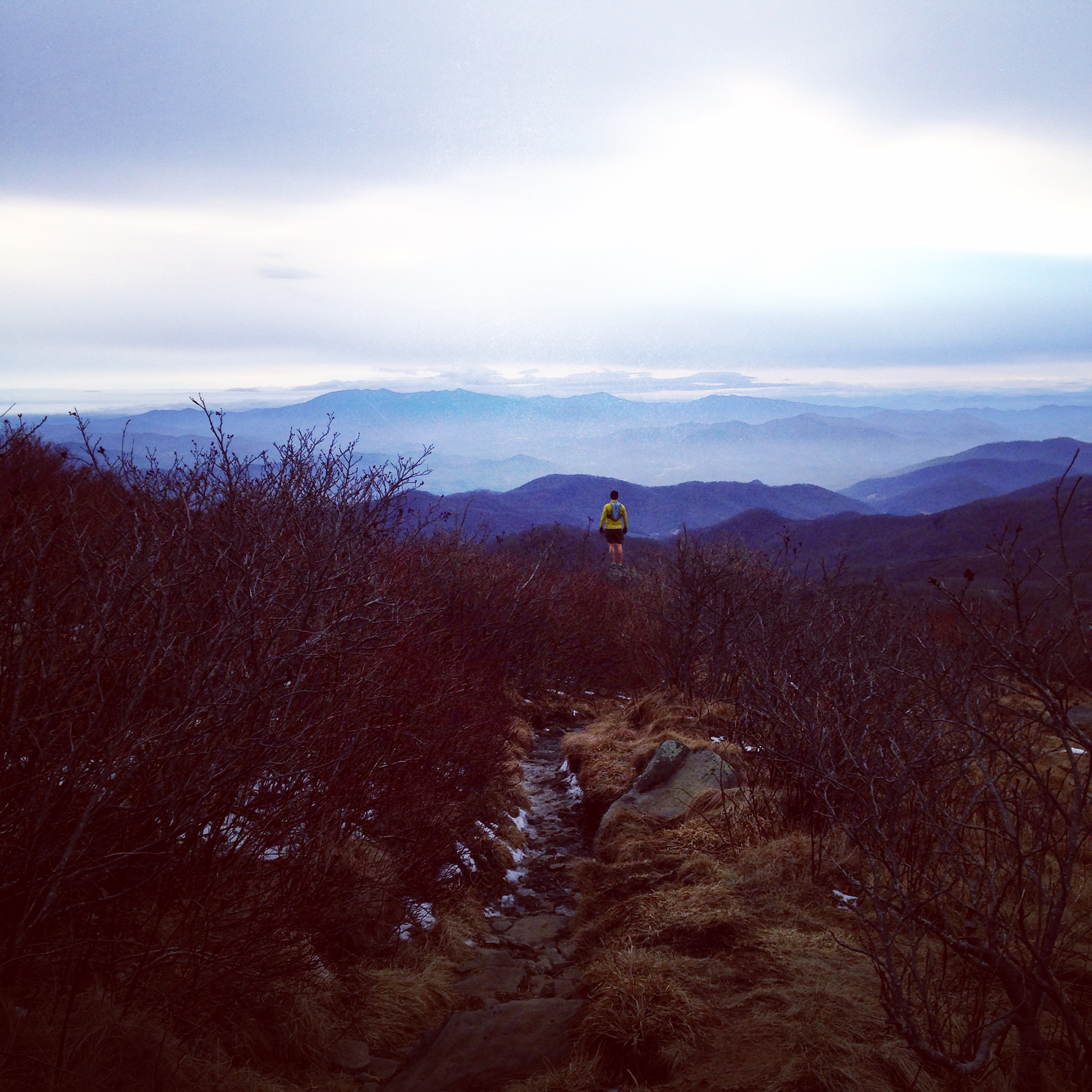
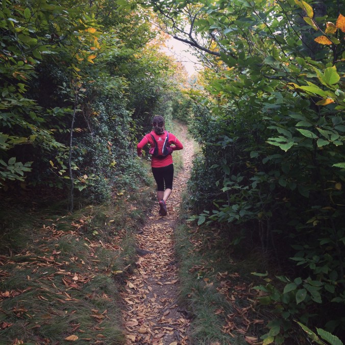
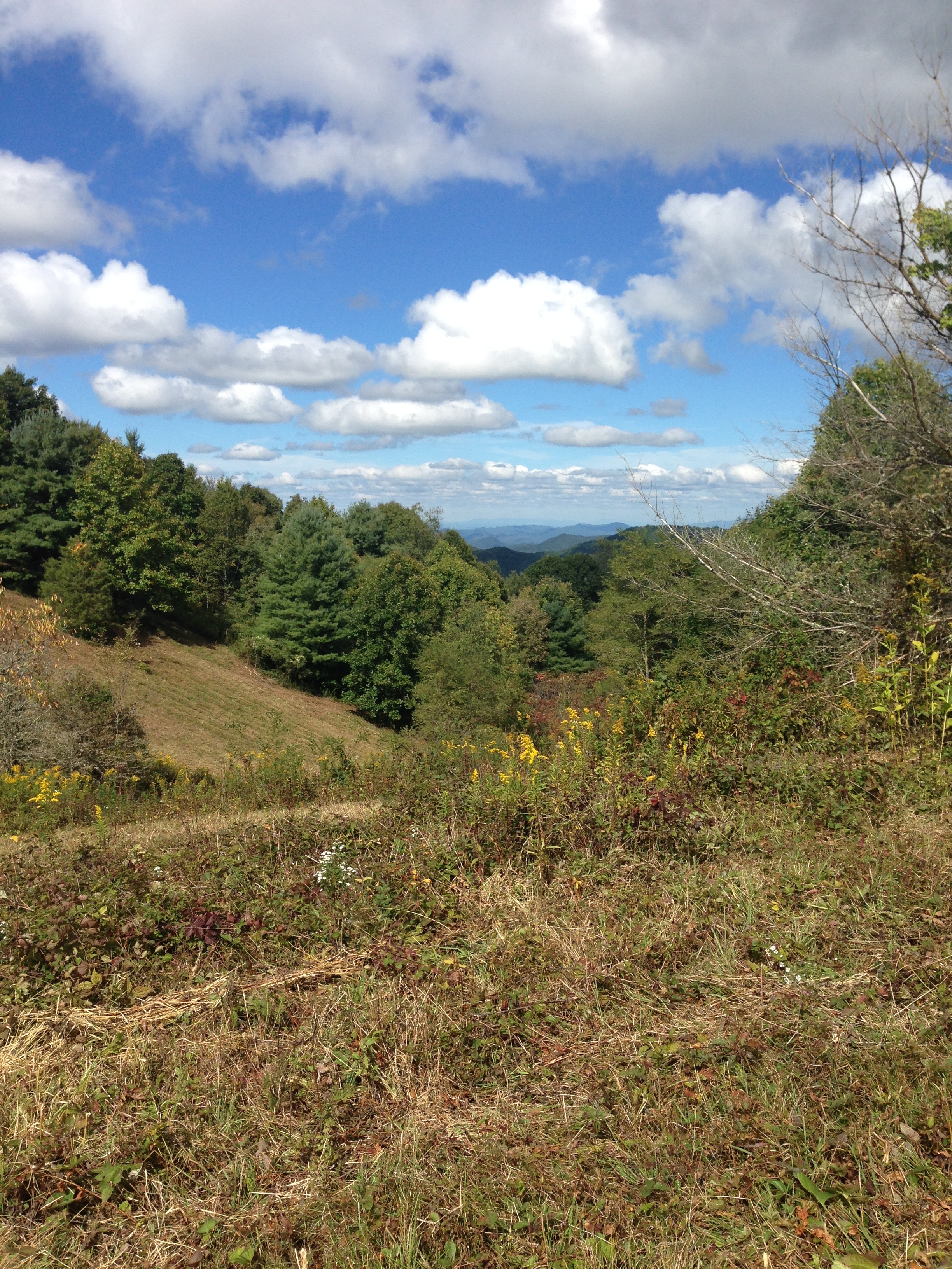
The Great Smoky Mountains National Park. The name sounds as grand and imposing as the mountains it encompasses. Surprisingly close to the glaring lights and endless man-made entertainments of Pigeon Forge and Gatlinburg, sits this pristine beacon of natural beauty and real adventure. The first time I visited, my husband and I were on a couple’s retreat with friends from church in the Pigeon Forge area. We were banking on getting some running in and knew the park was not far away, so we decided to check it out.  Little did I know how truly spectacular this place is, how intense the trails can be, and how common it is for spring snows to linger at those elevations. We got a couple runs in on that trip, one of which was extremely icy, and another that has become a particular favorite. The Appalachian trail section from Newfound Gap to the Jump Off is a moderate but steady climb that challenges and awes us every time we go. I still vividly remember the woodsy perfume of the pines that surrounded us as we passed into the higher elevations that first day. This, combined with plummeting views on both sides as we reached the apex of the Jump Off, created a stunning impression; even so, nearly four years passed before we managed to make it back to the Smoky Mountains and more specifically that trail.

IMG_1874

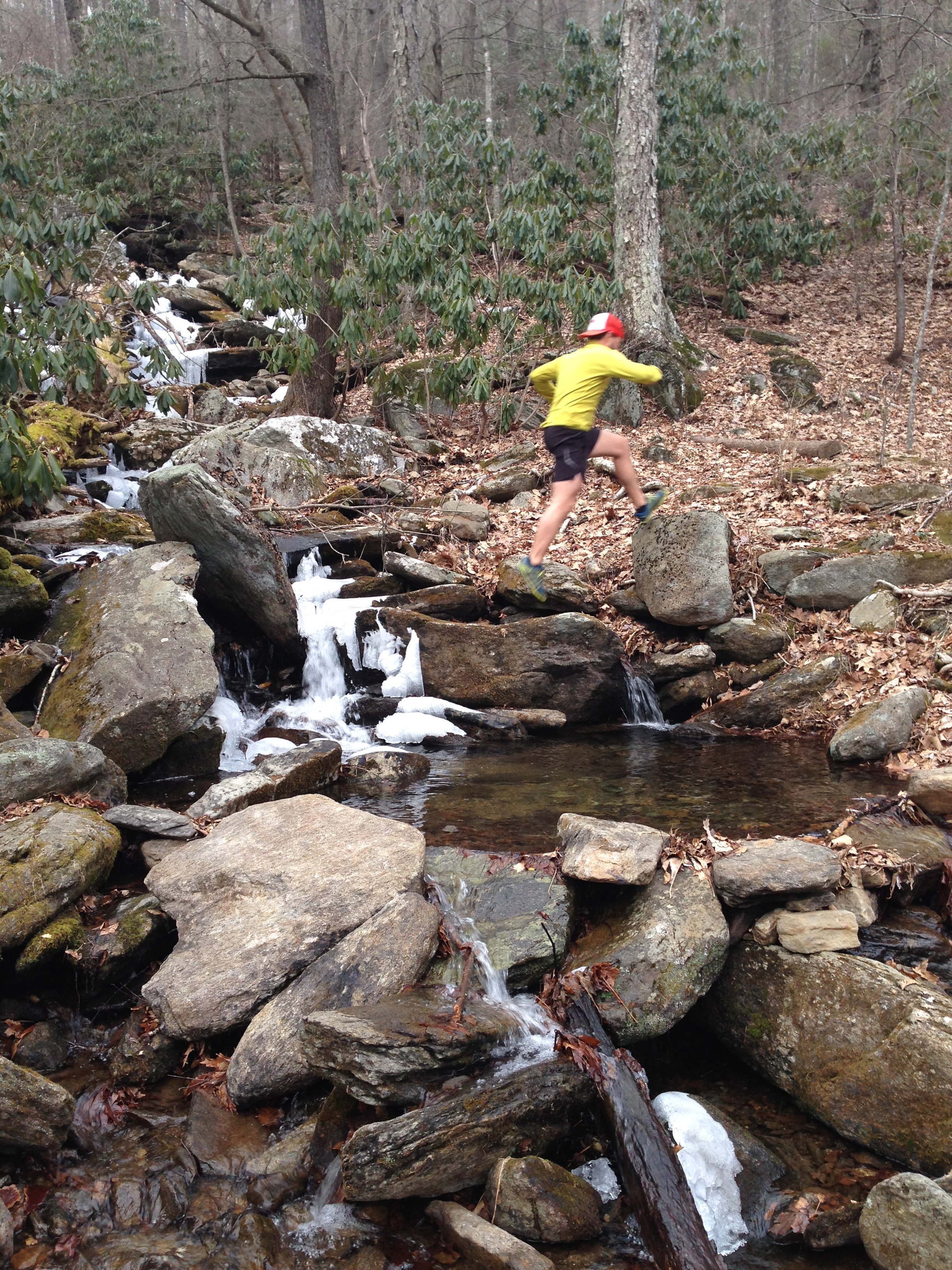
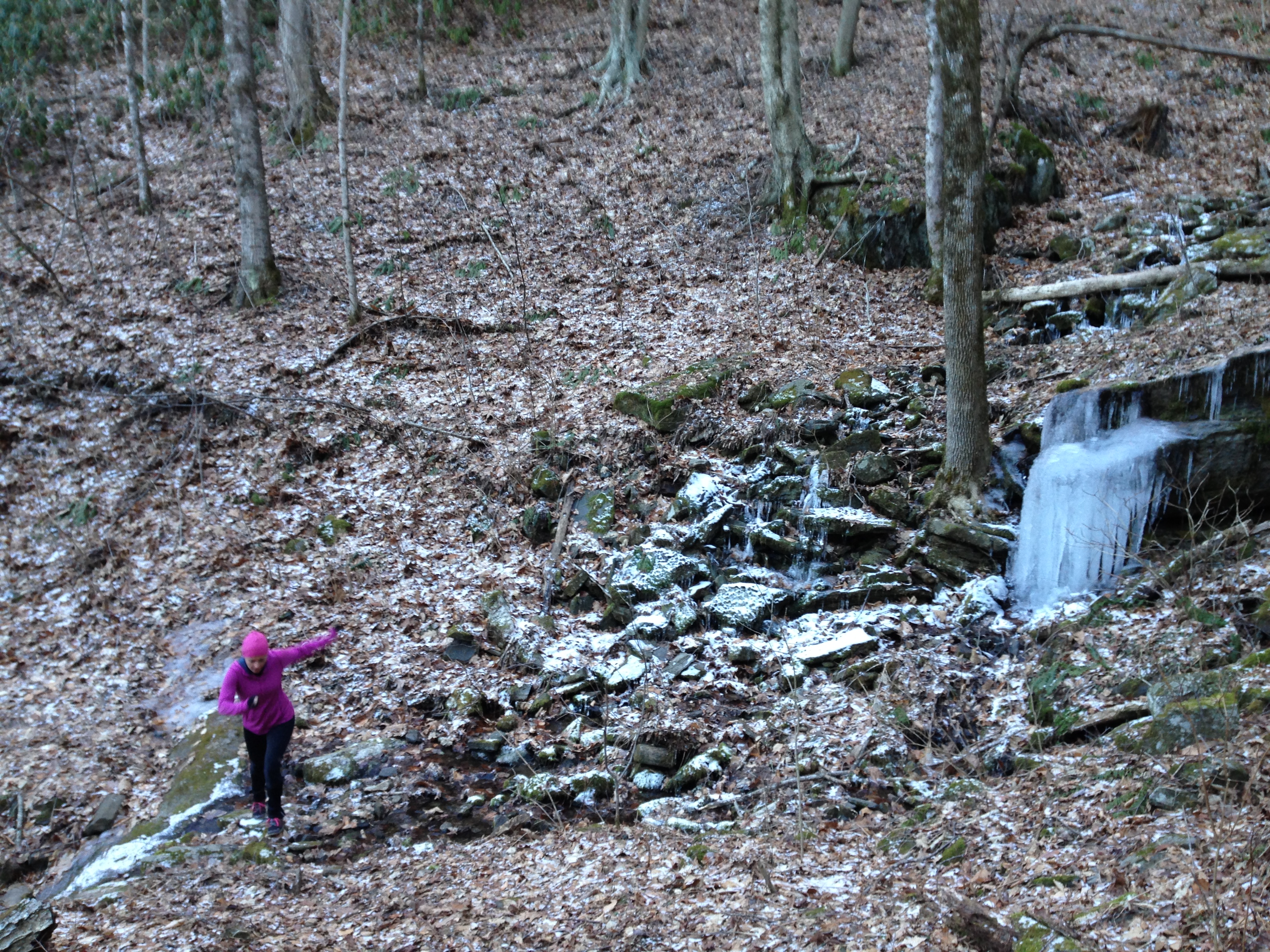
Ironically, we were returning from another couple’s retreat with church friends when we came within range of the park again. On a whim, we decided to detour in and re-attempt the Newfound Gap run. As we climbed the section of Appalachian trail leading to the Jump Off we quickly began to encounter a good bit of snow and ice. It was magical, but slow going and we ended up turning back before reaching the summit we had hoped for.

IMG_0571

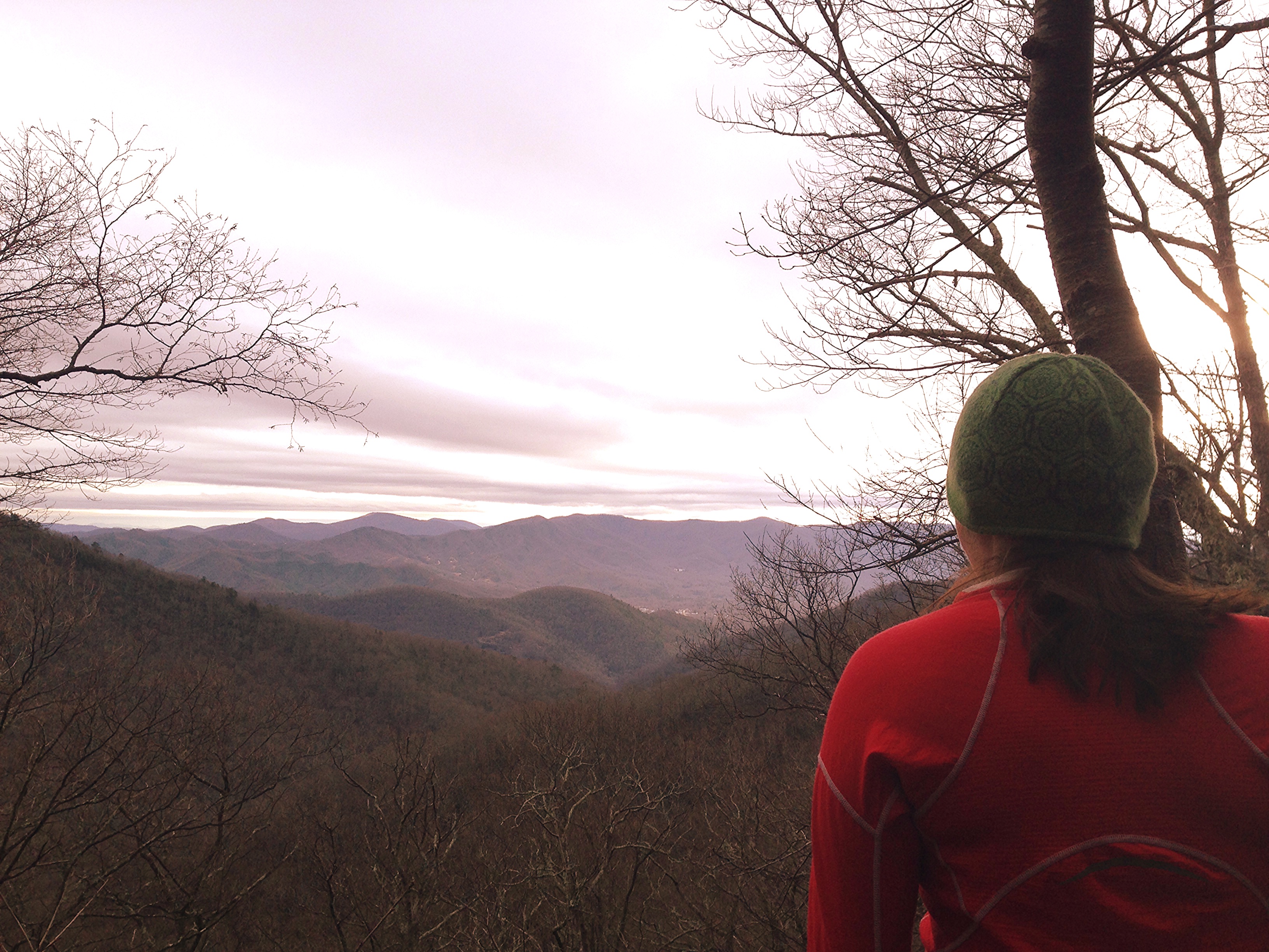
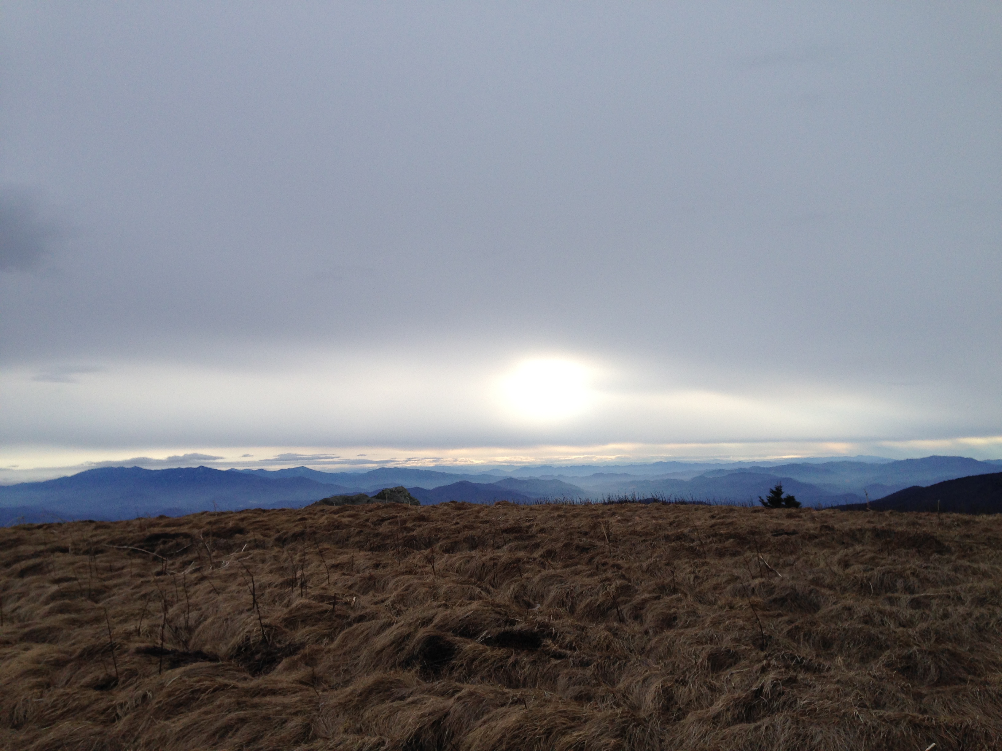
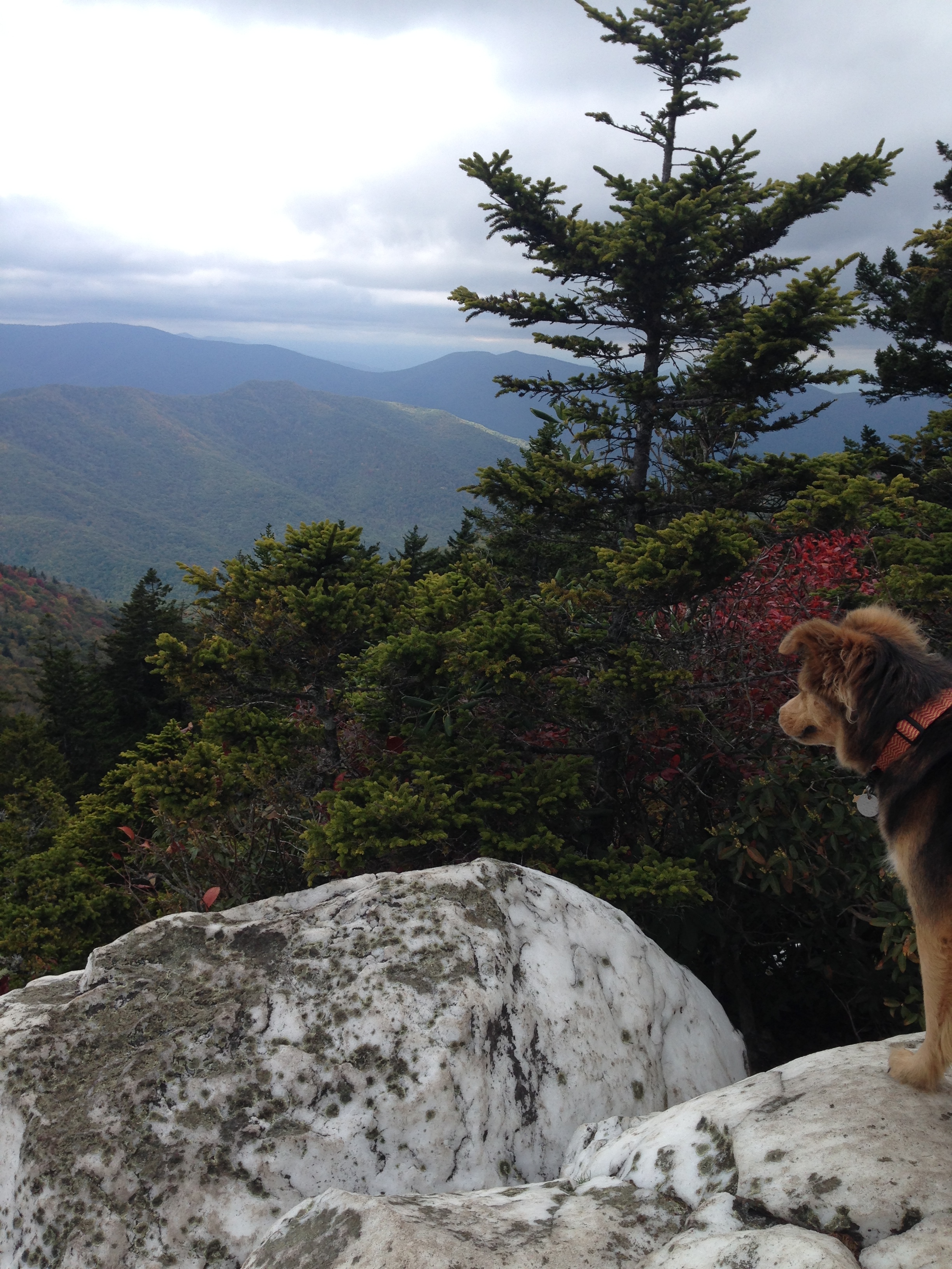
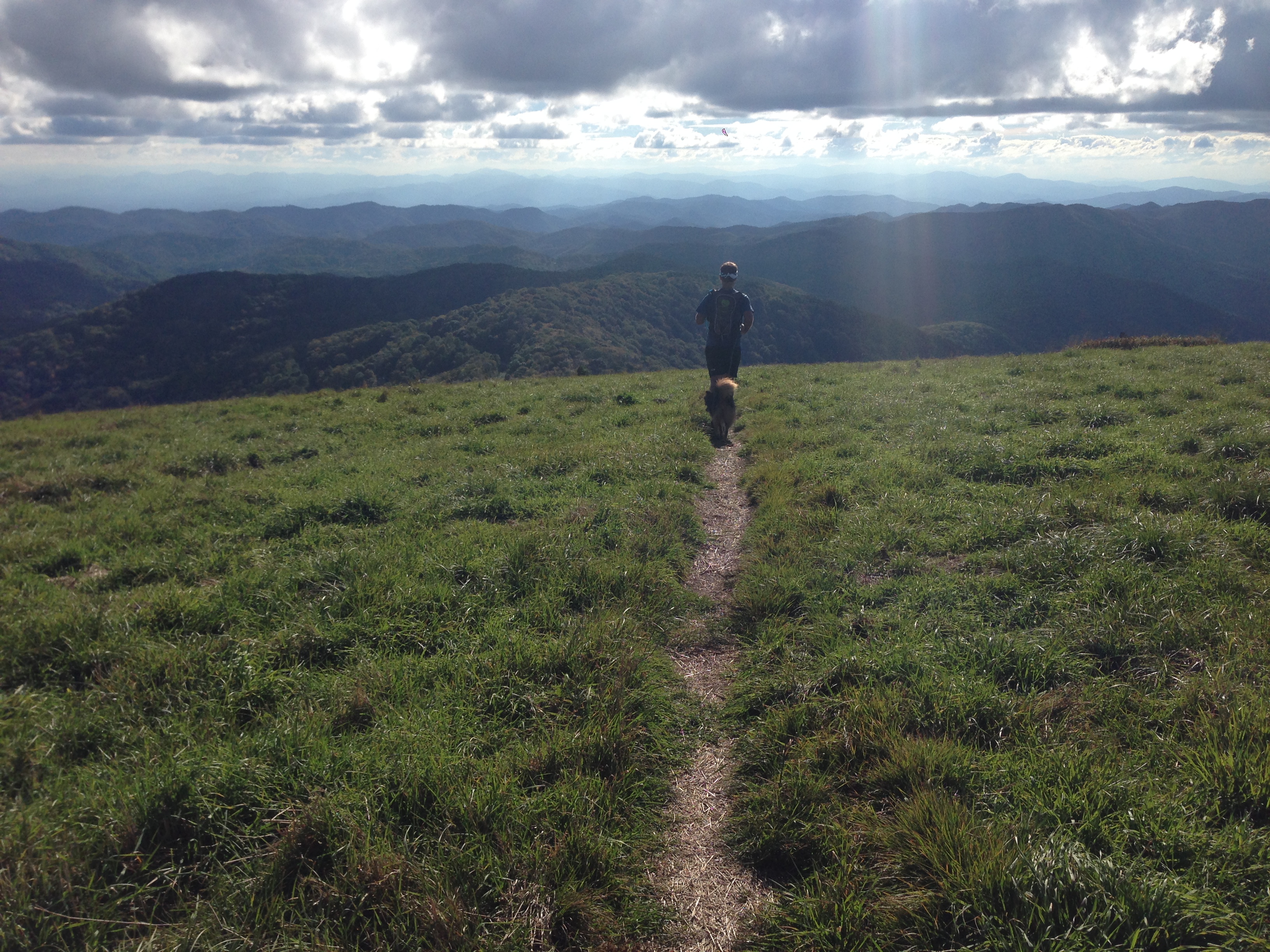
Nevertheless, the bug to run in the Smokies had taken hold and a couple weekends ago we managed to return.  With cool, sunny weather we plowed through the 3+ miles to the Jump Off much more quickly and enjoyed absolutely spectacular views. Though the drifts of several weeks earlier were melted away at the base of the trail, this ridge line still boasted fantastic snow-capped trees that looked as if they were perfectly coated with thick glistening icing.

IMG_2319

The wind was whipping through them ferociously creating a refrigerator effect that was kind of incredible, but also intensely cold. It was an exhilarating experience that reiterated the way in which each visit to an area can feel unique. So much can change the landscape and allow for different beauty, sights, and sensations.

IMG_2294

We returned from the spur trail that led to the Jump Off and kept plunging forward on the main trail to get in a bit of extra mileage. Signs pointed to Mount LeConte and we discussed the possibility of returning for a long run up and back to that famous peak, but for that day we just added a couple of extra miles before returning to the Newfound Gap parking lot.

IMG_2338

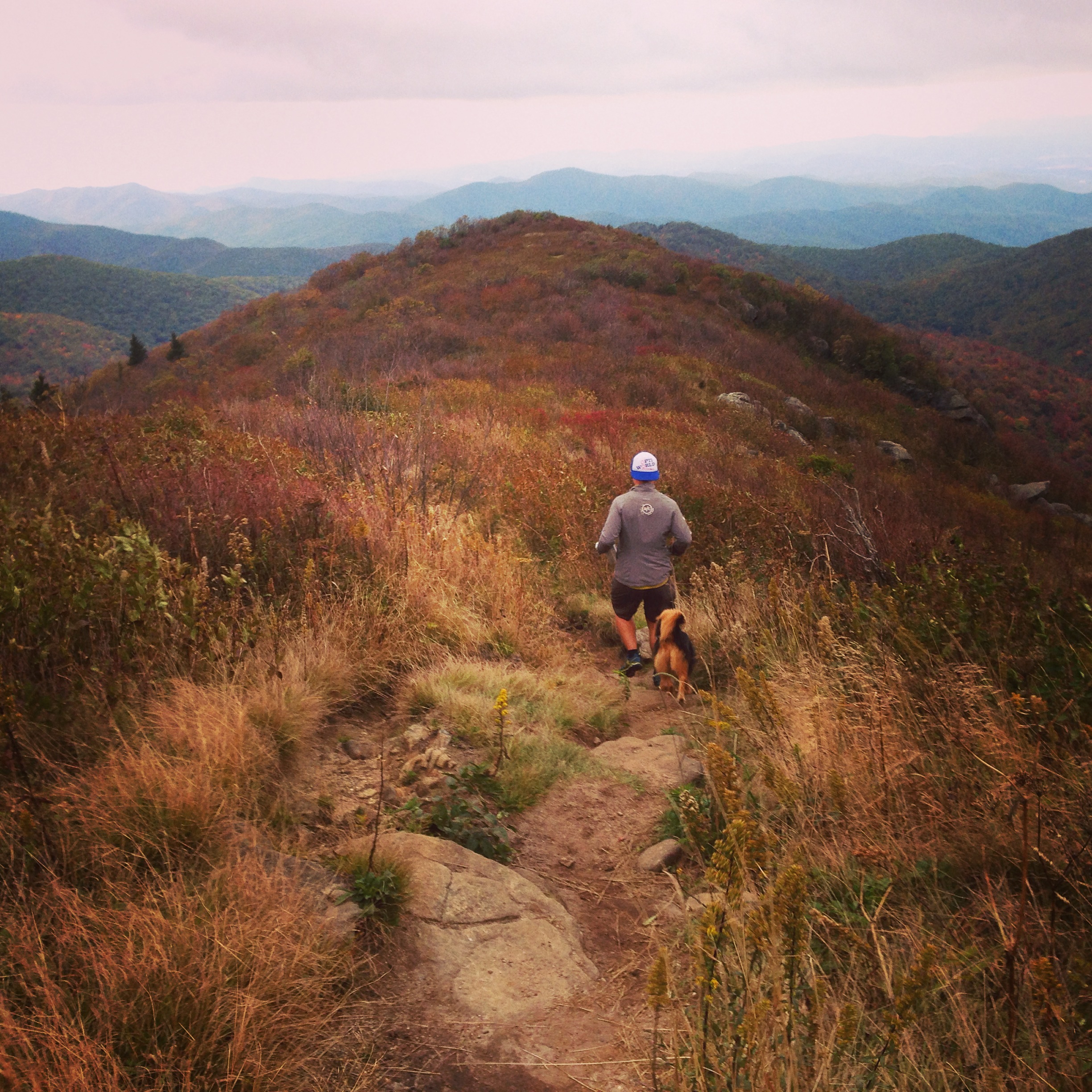
This run is so much fun. You are rewarded with great views along the way, the intoxicating smell of firs as you gain elevation, and a panoramic view on the Jump Off that is quite an epic finale (or intermission).

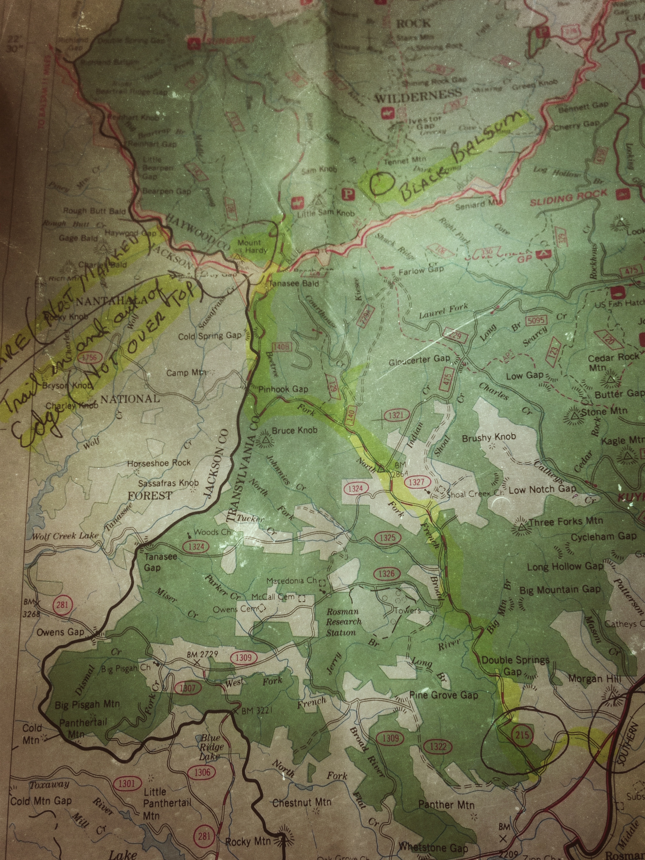
Getting Here:  This place is relatively easy to find. Just follow directions to Newfound Gap parking lot and take the Appalachian trail heading east toward Boulevard Trail and Mount Leconte. There is a sign for the Jump Off shortly past the Boulevard Trail. The trail climbs pretty steadily over the first half of the run, but you can enjoy a nice downhill on your return since this is an out-and-back route.

What to Eat: You have several options depending on your preferred route home and where you call home. If you’re heading back to the Upstate area, you can come through Asheville and hit any number of wonderful spots or if you get detoured off the Blue Ridge Parkway and end up in Rosman, NC (like we did) you can take your starving self over to La Casita. This was a delicious hidden jewel of a place in our book. We got the “special” guacamole, delightful endless chips and salsa, and split a trio of different enchiladas (chicken mole and verde) and a steak taco with a stuffed poblano instead of rice and beans. Everything was so good!

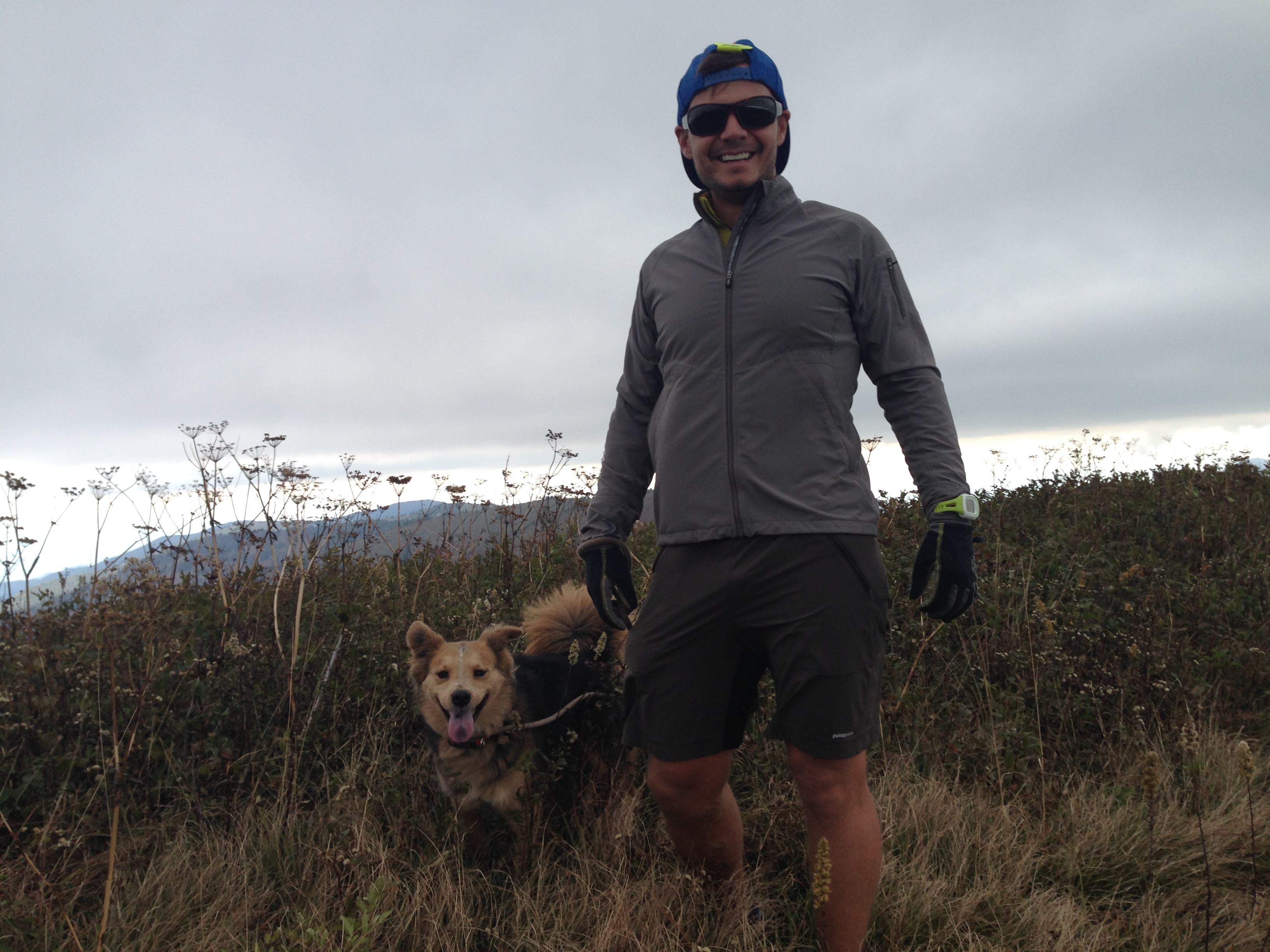
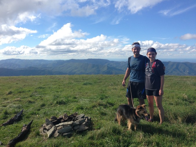
Good to Know: Cell service (at least for Verizon) is very spotty in this area. Make sure you have your directions pulled up and figured out before you enter the park. There are bathrooms here which is always a nice perk. Unfortunately, dogs are not allowed on this trail. It seems like that is pretty common knowledge, but we didn’t know until this trip that it is actually illegal and carries a hefty fine if you’re caught. Yikes!

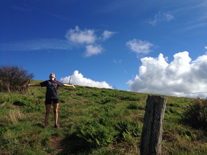
Keep looking for adventure far and nigh! Even when your smile is frozen 😉

Lake Robinson

IMG_2282

When we need a quick escape on the water, there is nothing like a sunset paddle on Lake Robinson. It’s only 25 minutes away from our house, the view is lovely, and it usually boasts very smooth calm waters.  If you visit on a clear day, there are gently sloping foothills and sharper angled mountains piling up at the base of the lake, but on any day you are treated to a heavily tree lined, very clean body of water that is quite pleasant and quiet. Motors over 10 HP are forbidden, so there is not much wake or high speed traffic to worry about, and with the exception of the odd fishing boat or pontoon, we have often found the whole 800 acre lake essentially unoccupied. Though Robinson is bordered by homes, they are well-spaced and Greer Commission of Public Works maintains strict guidelines about cutting down trees and building within the 50 foot margin they control along the shore. I’m sure this gets trying for the home owners at times, but it has kept the lake looking very peaceful and natural.

IMG_2505

For some amount of time, I had very little interest in Lake Robinson because of what felt like so many rules and regulations. I am not a rule breaker. I don’t like getting in trouble. Maybe it’s because I’m a firstborn, maybe it’s just being a people pleaser in general (something I’m trying to work on); whatever the case may be, it made me feel nervous to have so many do’s and don’ts, like it would be easy to mess up by accident and get scolded. Paddle boards are off limits ( a posted sign now states this specifically) and online there is a whole list of motorized and non-motorized water sports that are likewise forbidden. Swimming is also off limits in these enticing, pristine waters, and for awhile, I felt like half the fun of kayaking was being able to jump in if you wanted to! All together, I had the impression of Lake Robinson being a stuffy, somewhat stifling place, but I really hadn’t given it much of a chance.

IMG_9855

No rules against selfie sticks!

When I actually began to visit the lake and go paddling there more regularly, I found a lot to like. We had some very friendly interactions with the wardens (no scolding :)), and I decided that touring kayaks are not super conducive to getting in and out for a quick dip in the middle of a lake anyway. It’s doable, but not super tempting to me.  I also learned to appreciate Lake Robinson for what it is instead of being disappointed and intimidated by what it is not. If you want a spot where you can swim, roll your kayak, try out your new paddle boards, go camping or beach your boats for a picnic in a hidden cove–this is not it. (See instead, Lake Jocassee) However, if you live in or around Greenville and want to crank out up to 9ish miles of paddling in a lovely, peaceful setting before breakfast or after work, this is a very convenient spot. You can get to it quickly and the access area is very convenient, well kept and inexpensive (only $3/kayak * Update: The day pass price went up to $20 this year (2015), while the year pass remains $30. I think it’s safe to say they are encouraging the yearly pass. We found this change super frustrating, but the lake is still an amazing spot. ). There are many nice spots to just sit and soak in the beauty or eat a lunch. Nice bathrooms are available and supposedly there is some decent fishing to boot.

IMG_9680

After realizing this and getting more excited about paddling as an adventure-workout that is possible during all of our relatively mild seasons, I came to appreciate Lake Robinson much more. We have visited numerous times over the last few months and the convenience combined with its natural beauty have me fully sold on this spot. If you haven’t been, you should go, even if it’s just for a picnic.*

IMG_7292

Photo Credit: David Nigh

Keep looking for adventure far and nigh!

*Note: Kayaks can be rented at Half Moon Outfitters in Greenville, Rock’s Country Store across from the park entrance, and Sunrift Adventures in Travelers Rest. If you do kayak, make sure to bring a life vest and a whistle. Free whistles can be obtained from the warden, but you could be warned/or fined without these items. Passes are obtained from the warden’s office.

Nature’s Stair Master and a Cabin in the Woods

IMG_0004

This past weekend, we celebrated my husband’s birthday by making our way up to Bakersville, NC.  A friend mentioned Roan Mountain as a beautiful place we should explore, and since Bakersville is the “gateway to Roan Mountain”, it was the perfect jumping off point.  We discovered a lovely little cabin on VRBO called Birdtown Guesthouse which was situated about 25 minutes from the mountain and nestled amidst plenty of smaller peaks in its own right. The property is comprised of 60 acres including nearly 4 miles of trails. These trails were crazy–beautiful and fun, but crazy!

IMG_2912

The “easier” trail behind the cabin

As soon as we got there Saturday, we decided to strike out for a quick jog. The property owner warned us that one trail was somewhat steep and the other was VERY steep. We started on the “easier” trail and quickly decided that we might have gotten mixed up and landed on the steeper one. The trail climbed almost immediately crossing frozen streams and weaving through snow-specked leaf piles. It was intense and straight up for the most part until we reached an amazing ridge line with stellar views.

IMG_2908

View from the cabin

We retraced our steps and headed up the opposite trail only to realize it actually was the harder trail. It felt like a stair-stepper exercise machine that would not end. Our calves were burning, our glutes and thighs were on fire, and if something in our legs didn’t hurt on the way up, it got jostled and shaken until it did on the way down. We were kind of cracking up, between heaving gasps for air, about how we thought the other one was tough. Thankfully, the payoff in views was well worth the push up those hills. The second trail opened up into a meadow on top of the ridge and again we got to soak in waves of mountains basking in the chilly setting sun.We could not get over how cool it was that this cabin had such incredible trails right out the back door. Though the mileage was not particularly extensive, the workout was more than enough.

IMG_2935

Jane Bald in the distance

The next day we headed up toward Roan Mountain and the Appalachian Trail at Carver’s Gap. This area is right on the Tennessee/North Carolina line. After all the hype we had built up in our minds about Roan, we actually  ended up running North on the Appalchian trail (the opposite direction) towards some other balds.

IMG_2961

From the ascent of Jane Bald

Round Bald (5826′), Jane Bald (5807′), and Grassy Ridge Bald (6139′) comprised the majority of our run, and they did not disappoint. The views were absolutely incredible. Summiting these three balds and coming back was a distance of about 5 miles. In spite of gray skies and a very blustery wind, we had a wonderful run and cannot wait to go back.

IMG_3031

Grassy Ridge Bald

Getting There:  To get to Roan Mountain or this section of the Appalachian trail, type Carver’s Gap, Pisgah National Forest, Fork Mountain-Little Rock Creek, NC 28705 into your GPS or google maps. To check out the awesome cabin  and access those trails, look on their website or find it on Airbnb, VRBO, or Homeaway under Bakersville, NC vacation rentals.

IMG_0008

Coffee on the back porch of the cabin

What to Eat: Food is always a consideration, but if you plan on going up here, especially in an off season (like January), you really need to plan well. There are not many places to begin with and in winter many are closed or have limited hours. Bakersville has a Dollar General where I imagine you can get some snack things and basic groceries. Spruce Pine is probably 30-40 minutes away from Carver’s Gap and they have a very good pizza place called The Pizza Shop at Dry County Brewing. Knife and Fork is also very good as well as their bar, Spoon. Both places have excellent farm to table fare. In Bakersville, there were a few restaurants that looked fun, but nothing was open over the time that we were there. Again, I think a lot of this had to do with it being off-season. One other cool stop in Bakersville is Oak Moon Dairy and Cheese shop. This place was so cool! The goat cheese is incredible.

IMG_3010

Good to Know: This may be obvious, but it is colder at those higher elevations than it is in town. Make sure you pack good layers. Also, phone service is VERY spotty. It’s decent in Bakersville, but pretty bad on the trails and at the cabin.

IMG_9999

Look for adventure far and nigh!

A Christmas Tree Expedition and Foothills Trail Run

IMG_9595

This year everything seemed to fly by and the holiday season is proving no exception. Thanksgiving came and went and suddenly we were a week into December with no Christmas tree.  Every year since we got married, David and I have gone somewhere special to pick out a Christmas tree and chop it down.  It’s unnecessary and sometimes overpriced, but it’s also a really fun tradition. I highly recommend just going for it, at least once. The last two years we have gone to a place called Zeigler’s in Brevard, North Carolina. It’s family run, beautiful, isolated in the middle of Pisgah National Forest, and very reasonably priced.

IMG_9634

We were headed there this year with the intention of snagging a tree and catching a run in the mountains on our way home, but daylight was fading quickly. As we were sorting through our options, we stumbled upon another smaller farm right along the road and decided to check it out. The trees looked so perfect and they were advertised as the highly desirable Fraser firs. We decided it couldn’t hurt to do a price check and ended up getting a gorgeous 10-11 foot tree for $45!  It was such a cool Christmas blessing, and since it was 45 minutes closer than the other spot we had enough daylight for a quick run on the Foothills trail. 

IMG_9584

The Foothills trail is a legendary spot to us. We have heard several crazy stories about it–friends thru-hiking it over a weekend ending in tears of relief, others attempting it only to be thwarted by exhaustion induced illness etc. There have also been some amazing photos posted of it, vistas overlooking Lake Joccassee, plummeting waterfalls and winding single track trails.  This past weekend, we finally got our first taste of this spot and it was kind of by accident. We were headed up to get the Christmas tree when we decided to follow a large wooden sign that pointed to the Foothills Trail just to see where it took us and what it was like.

image-3 

In the parking area at the top of a winding dirt road, we found this weathered sign which pointed to Laurel Falls 8.1 miles away. We knew from some earlier research that this falls pours into the stunning expanse of Lake Joccassee. It was amazing to us that one of our favorite destinations was only 8 miles away down the Foothills trail. Since we only had about 30 minutes of daylight left after getting our giant Griswoldian tree hoisted onto the car, we did not make it to the lake; however, we did get a little taste of an awesome new trail that is just over an hour from Greenville. Now we are plotting a mild winter day excursion run to the lake and back. Who’s with us?

Getting There: Head up 178 N (Pickens Highway) toward Brevard.  A large wooden sign denotes the Foothills Trail on the left. The small Christmas tree farm is on your left about 10 minutes past this sign. If you reach signs for The Wilds camp (also on the left), you’ve gone too far by about a mile.

Running the Trail: Proceed up the winding dirt road past the wooden sign for about half a mile. It will lead you to a gravel parking area or the road continues (we did not explore beyond the parking area by car). On foot, head towards the continuing gravel/dirt road and almost immediately you will see signs for the Foothills Trail on the right and steep steps leading up from the road into the woods. Run out and back as far as you like following the white blazes.

image-2

Look for adventure far and nigh!

Art Loeb Trail Run- Black Balsam to Shining Rock Loop

Art Loeb Trail, Tennent mountain near Black Balsam Knob in Shining Rock Wilderness, Trail Running

Location: This is an amazing trail with stunning panoramic views of the mountains, Shining Rock Wilderness, and Pisgah National Forest. The section of the Art Loeb Trail beginning at Black Balsam Knob, is beautiful and challenging.  There are ups and downs, technical footing, and a lovely variety of sceneries.  It is great for hiking or running. We completed a roughly 9 mile loop that included one section of out and back running. The exact route we took is detailed below.

Getting There: Black Balsam Knob is about 1 hour 45 minutes away from the Greenville area. If you’re leaving Greenville, take 25 N towards Hendersonville to 26 W. Get off at Exit 37, turn left NC-146 W. Take a right on Clayton road. Continue 1.3 miles. Slight right onto NC-191 N. Continue 1.2 miles. Turn left onto the Blue Ridge Pkwy. Continue 26.8 miles. Then, turn right onto Black Balsam Knob Rd. Continue to the end parking lot or park in one of the designated spots along the road. The Art Loeb trail begins on the right side of Black Balsam Knob Rd. as you’re driving in towards the parking lot. There are parking spaces beside the trail head and it is well-marked.

What to Bring: Running shoes- preferably trail shoes, lots of layers- It is always colder here than in the valleys and the weather can be very changeable at this altitude (around 6,000 ft), water/snacks (for during or after since you’re a bit isolated from restaurants and stores), change of clothes if you run it and don’t want to feel sweaty or chilled all the way home

Where to Eat: We love having a fun meal to look forward to after a big run. Farm Burger in Asheville, NC is one of our current favorites and an easy detour on the way back from Black Balsam (roughly an hour from Black Balsam). West First Pizza in Hendersonville, NC is another awesome post-run stop (also roughly an hour). We’ve enjoyed Mayberry’s Soups and Sandwiches in Brevard on several occasions too (around 45 mins away).

Art Loeb Trail to Shining Rock Wilderness

What an enchanting run this is. David and I have run and hiked parts of this loop on multiple occasions, but until this day, we had never delved very far into the Shining Rock Wilderness. We needed a longer run since we were training for a trail half marathon and we always like having a goal destination to run to, so we decided to try to find Shining Rock. Until planning this run, I didn’t know that there was in fact a “shining rock” which gave the wilderness area its name. As it turns out, there is snow white quartz at the top of a mountain in the wilderness area which is rather eye catching amidst the other more common rock features in the area.

IMG_1873

View from the top of Shining Rock including some of the unusual snow quartz.

We parked at the trail head for the Art Loeb Trail which is found on Black Balsam Knob road. Our run took us up and over Black Balsam Knob and Tennent Mountain, through a large gap-like clearing area with signage pointing towards Ivestor Gap and then through Ivestor Gap itself where we were welcomed to the Shining Rock Wilderness. Here we decided to stay to the right on the Art Loeb trail instead of taking the left fork onto Ivestor Gap trail. We tried to stay on the Art Loeb for our entire outward journey just to keep it simple and avoid getting lost.

IMG_1856

This led us around and over another mountain which I believe was Flower Knob. It was kind of hard to tell because once you’re in the wilderness area nothing is signed. We got to a smallish grassy clearing eventually where there was a piece of orange/pink tape dangling. This seemed to mark the spot where Ivestor Gap trail emerged from our left, but we weren’t positive about that either. We kept going along a bit of a ridge line until we started climbing once more. We had begun to wonder if we were still headed the right direction when we hit over 4 miles with no sign of the white quartz that would mark Shining Rock, but at last it started to appear scattered along the path. We hit the top around 4.5 miles which was what we had hoped would be the case based on our research of this route. After some pictures, we turned back retracing our steps exactly until we came to the clearing at the base of Tennent Mountain. Instead of ascending on the trail to the left, we took the lower trail to the right which circumvents Tennent and Black Balsam returning you to the parking lot at the end of Black Balsam Knob road. This path is pretty wide and flat, however there are a ton of loose rocks, and if it’s rained lately the whole thing can be somewhat flooded. This does not make it impassable, but it can slow you down if you don’t want wet feet.

The only bummer about looping back like this is that you have nearly half a mile on the road once you reach the parking lot if you parked at the Art Loeb Trail head. We always dislike ending on pavement after longer runs. It just hurts, but finishing the loop is satisfying and at least the footing was super easy! If you need a great day hike, trail run, picnic or backpacking spot, this one is hard to beat. You could go out for a much shorter distance and still enjoy stunning views and wild beauty. Keep looking for adventure far and nigh!

IMG_1832

Sam’s Gap to Big Bald Trail Run

Big Bald, Appalachian Trail, near Asheville, North Carolina

Big Bald in the distance

This is an awesome trail run or hike. The views from the top are outrageously stunning. Follow the white rectangular blazes to stay on the AT. The hike is 6.5 miles out and 13 miles round trip. There are a couple of springs along the way which are nice for rehydrating your canine friends. We carried hydration packs, but I guess you could also treat the spring water and carry less in. The run took us about 3 hours and 20 minutes. That included a decent number of photo stops along the way, but not our time at the top. More details about the run can be found below.

Getting here: Head north out of Asheville on I-26 N until you get to the Wold Laurel ski lodge exit. Take a right off of the exit. Go over the bridge and take a left on 23. You will pass Little Creek Cafe and continue a couple of miles until you see a parking area on either side of the road right before it passes under an overpass of I-26. We parked in the parking section on the right and jumped on the gravel walking path that led to the AT. Across the road (on the left side), the AT heads south to Hogback shelter. If you end up there, then you have gone the wrong direction.

Where to eat: Treat yourself to Farm Burger or any of the other amazing Asheville restaurants that you will pass on your return journey.

IMG_8763

View from the top

Today, I want to talk about a run from this past weekend that is definitely one of the most breathtakingly beautiful and awe-inspiring excursions we have ever done. As previously mentioned, my husband and I absolutely love trail running. It is exhilarating, interesting, challenging, and satisfying in different ways each time we go; however, some runs really reinvigorate your whole perspective on the sport and get you excited about exploring and pushing yourself to new limits. Our run to Big Bald, one of many stunning spots along the famous Appalachian Trail, did exactly that. We first heard about it as a running destination through an awesome blog called iRunfar.com. Here it is listed as a moderate run about 30 minutes outside of Asheville. One picture was enough to make us drool and instantly decide we had to find this place. Once found, it did not disappoint.

IMG_8771

Running off the edge

The trail to Big Bald from Sam’s Gap is around 6.5 miles long one way, 13 miles round trip. It is replete with the characteristic ups and downs that the AT is known for and sprinkled with different terrain and teasers of the big views ahead. A couple sections are particularly steep, one about a mile in and the other about 5.5 miles in, but much of the trail is just rolling or gradual incline.
IMG_8716

Though our goal was to run the entire thing, some power walking had to happen in places. We have learned to embrace that part of mountain running instead of feeling defeated by it. Sometimes walking is more efficient and sometimes it is all you can do to keep moving forward. It’s a killer workout any way you slice it. Power hiking a mountain doesn’t exactly make it a cake walk…unfortunately.

Dogs on Big Bald on the Appalachian Trail

When we hit the last steep section before the bald, we began to wonder if we would ever arrive at our destination and if it could really be worth all this effort. We had gotten a kindly tip from a descending hiker that we were “close”, but obviously that means different things to different people. So when we had continued another quarter mile without evidence of Big Bald, we started to feel our burning legs more keenly and lose some momentum. As so often happens, this low point hit as we were finally nearing the goal. Just a few minutes later we emerged from the forest into bright sunshine, waves of mountains, and a grassy slope that disappeared into the bluest sky dotted with cottony clouds. It took my breath away and made me want to cry it was so beautiful. The fact that we had been running for over 90 minutes, just heaved up one final hill and been on a small emotional roller coaster (thinking it was just around the corner only to find out it was not) might have been playing into my feelings a bit, but even as I sit here remembering that moment, I am moved. The whole scene was magnificent, unbounded and for several minutes, we were the only ones in the world experiencing it.

Near the summit of Big Bald on the Appalachian Trail

Throughout the whole hike we passed only a handful of hikers and one group of people camping about 2 miles in. After reaching the top, we were joined by a solo backpacker and two other day hikers. Since it was Saturday and the weather could not have been more perfect, I’m assuming that was a busy day and it was still very peaceful. If you are in the Upstate or western North Carolina, this is a must run and/or hike. It is so worth the effort.

Keep looking for adventure far and nigh!

Grassy Meadow Summit of Big Bald on the Appalachian Trail near Asheville, NC

Jones Gap State Park Trail Run

IMG_6471

May 13, 2014

If you live anywhere in the Upstate and have not yet discovered Jones Gap State Park, you are missing out. It is a verdant pocket of forest, divided by a clear, bubbling mountain stream that shrinks and expands as it traverses the park. The area is speckled with waterfalls, both large and small, which make for great hiking/running destinations, and as we recently discovered, the opportunity for some pretty noteworthy mountain running experiences.

IMG_6462
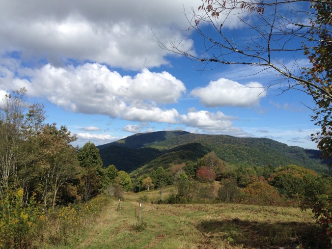
Over the past few years, my husband and I have run, hiked, camped, and explored this area in multiple directions. I will be sharing several adventures from this place, but I had to begin with our most recent new discovery: The Rim of the Gap trail. I have seen this intriguing trail name on the map since we began coming to Jones Gap; however, that interest was tempered by some things we heard early on about its high level of difficulty, several bear sightings, and its closure during the winter because of ice accumulation. The rumors made it feel ominous, intimidating, out of our league and far more wild than your average South Carolina state park. So on this rather muggy May day, we were not expecting to just take a little jog on this crazy beast of trail, but that is exactly what ended up happening.

IMG_6469

We arrived in the late afternoon, decked out in running gear and excited to try our new-ish hydration packs on a run where we might actually need the extra water. As we perused the map, we were approached by a ranger who wanted to warn us about the trails closing an hour before sunset. With disappointment, we realized we probably couldn’t tackle our 10.5 mile arch-nemesis, the out and back Jones Gap trail that we had been attempting to complete off and on for awhile. We had made a half-joking “vow” to ourselves that we would not return to the park or at least not that trail unless we were ready to just finish it, so we had quite the dilemma. That’s when we asked our new ranger friend  about the Rim of the Gap trail. Is it runnable? Is it crazy? How long is it? Overall, he downplayed the whole thing while simultaneously telling us the elevation gain was significant, around 1400 feet but also pointing out a 5.5 mile loop that only involved a portion of Rim of the Gap before cutting across on a connector that linked to Little Pinnacle Mountain via the Pinnacle Pass trail. This is what we ended up running and it was amazing. It was crazy, but very cool.

IMG_6474Almost immediately, the trail starts climbing and we were huffing and puffing and just barely power hiking our way through certain sections. Then we came to a rock you have to climb over with the help of a cable, and we knew this was going to be one of our more epic and memorable runs. The trail climbs and climbs, but thankfully the forest is so beautiful. We felt certain that we were experiencing almost of all of the elevation gain for the whole trail as we crept along, telling ourselves this was a killer workout even if we were barely moving in multiple places. You have to pay attention to the signs and blazes along the way, but the trails are well-marked. When you get to the turn for the connector and move on to the Little Pinnacle trail, you begin to get steep downhill sections that provide some relief for the legs, but also require a great deal of caution. The highlight of the whole run is the view you get just past the Mountain Bridge trail marker 20, pictured above. We were not expecting things to open up like they did, so it absolutely stunned us to see the waves of mountains and sky burst through the trees.

IMG_6491

I would totally recommend this as a hike or a run. It is so beautiful and the distance isn’t too intense. While later parts of the Rim of the Gap are apparently far more treacherous, this section was really not terrible. You get enough elevation gain and rock hopping in to feel pretty hardcore, but you also are not forced to inch along any narrow ledges or cross waterfalls with a cable (From what I hear, there may be some of that further up the Rim of the Gap trail). The downhill sections were what felt the most dangerous to us, but we just took it really slow in those areas and did not have any problems.

IMG_0152

Recommendations: Bring water and a snack in case your adventure takes longer than planned. There are plenty of spots to stop and rest if needed, and it’s nice to refuel a bit along the way. Definitely wear shoes designed for hiking or running that have some traction. Also, keep in mind that you could be out for a good chunk of time. We were running (as much as possible) and it took us around 1 h:45mins. That is a good bit longer than our normal 5.5 mile run :). Also, be very careful on the steep sections, particularly the rocky downhill sections, and I would probably avoid this during a torrential downpour if possible. Always remember to exercise caution on unfamiliar terrain, and fill out a hiker check-in before you start.

Enjoy the gorgeous views and keep looking for adventure far and nigh!

Santee Surf and Turf Triathlon & Biathlon

photo-7

Rounding the bend at the turn around point

April 26, 2014

Trail Run + Kayak + Mtn Bike + BBQ= AWESOMENESS. This is the tagline that drew us into a race comprised of 3 miles trail running, 3 miles flat-water kayaking or 1.5 miles SUP, and 8 miles of mountain biking for the triathlon option. Who wouldn’t be intrigued by the sound of that adventure party? Three fun sports followed by BBQ, is difficult to pass up. Evidently, Adventure Geek Productions has been putting on some form of this race for the last 4 years, but we have never heard anything about it until we stumbled upon it via the internet one evening about 3 weeks before it was due to take place. We were super excited because the distances for this race are not crazy long and it is a unique combination of disciplines for a tri or biathlon.

Once we discovered this event, we immediately tried to talk several different friends and family members into doing it with us, but with only a few weeks notice, there were no takers. Despite our initial excitement, we went back and forth about it for quite a while, halfway training and allowing the signup deadline to creep closer and closer. Finally, with only hours to spare we signed up. David picked the triathlon, because he is a beast in possession of a sweet new-to-him mountain bike, while I opted for the easier biathlon which took out the biking. With some trepidation, we loaded up our gear and headed south, joined by a couple of great friends who agreed to hang out and kindly helped with water, gear etc.

The lakefront course and the beach (photo credit: Garrison Morris)

The lakefront course and the beach (photo credit: Garrison Morris)

We arrived about an hour and a half before the race started, checked in and got instructions about where to station our kayaks on the beach. It is a first come, first serve situation for getting your paddling position so we were glad to be there in enough time to have a couple options left. My husband and one of our friends carried the boats down and strategically picked a spot by some very cool racing kayaks. While we were getting situated we met a super nice couple who had done the race multiple times before. They provided some great insider tips about where the run dumped out and the distances between the run finish line and the kayak start. This definitely helped to ease our nerves, but everyone around us looked so hardcore and intense, we still felt like we might get destroyed in each of our respective races.

To begin the event, they gathered everyone at the start/finish line and directed us into the woods where we followed red arrows for the run and passed blue arrows that directed mountain bikers during the third leg of the race. The race started almost at a diagonal left, across an open grassy area, past the bike staging zone as well as some picnic spots. That was the only slightly confusing part of the race. We had never run at Santee before, so we didn’t know where the trail was going to begin and as previously stated it wasn’t really a straight shot out of the start line. After we got into the woods, turns were clearly marked, and the course was pretty flat and easy, covered in packed dirt and pine needles. As soon as we hit the finish line our kayak time began. We ran a little more than a quarter of a mile to the boat launch, threw on our pfds, and got launched by the volunteers. The kayak course was two 1.5 mile loops that paralleled the shoreline. If you used an SUP (we did not), you only had to do one loop. Once we finished that, we hopped out of our kayaks as quickly as possible and ran back to the start/finish line. For me, that was the end of the race. David changed shoes, strapped on his helmet and hit the trails again for the 8 mile bike ride. The biking definitely added a significant level of challenge to this event. It wasn’t steep or super technical, according to David, but doing three events over two is definitely more exhausting. Still, we both had very solid finishes. David was 11th overall in the triathlon and I won the much smaller biathlon.

IMG_6319

Final pump to the finish

All together, I would heartily recommend this event. It’s a unique challenge to do multiple activities back to back, and we appreciated the fact that this tri/biathlon was off-road and did not involve swimming, a sport we are definitely not in shape for right now. You can rent kayaks through several different outdoor vendors connected to the race which is helpful if you don’t own a boat, and the field of participants is not huge which we found less intimidating. The post-race party atmosphere was great too, with food, plenty of Heed and water, and great camaraderie. If we do it again next year, I would definitely work on my biking and try to do the triathlon, but the biathlon is a great option if you don’t bike. The race can also be run as a team, so grab some friends and start planning for next year’s Santee Surf and Turf Triathlon & Biathlon.

IMG_0092

Please note the ample BBQ and the Start/Finish line behind us 🙂

Keep looking for adventure far and nigh!

For more details about this race and other fun events sponsored by Adventure Geek Productions check out this website: http://www.adventuregeekproductions.com/santee-surf-and-turf.html

Middle Prong Wilderness Backpacking

IMG_6163

Exploring the meadow

For some reason, we have yet to get motivated to do a winter camping trip. In some ways, it’s silly because we live in the Southeast and spring or fall temperatures at 6,000 feet elevation are often just as cold as anything we would encounter at lower altitudes in the dead of winter. Regardless, we have a mental block about it and just don’t get motivated to gear up and go during the winter. So when spring, in all its wishy washy starts and stops begins to melt and green the landscape, we inevitably feel that the time has come to venture out into nature. This year we had the added pull of friends who invited us to join them. Remembering that semi-spontaneous backpacking is often the only way we end up doing this sort of thing, we immediately accepted the offer and quickly started planning.

On this occasion, we got an amazing recommendation from Bob, a church friend who has spent many years as a scout master and an adventurer at large. We were relaying our customary debate of whether to return to an old, beloved location or explore somewhere new with the risk of disappointment, when he described a place he had nicknamed “the Shire” because of its wild beauty, quiet green paths, and dramatic scenic views. Immediately, we were captivated, and I definitely felt like any place besides the Shire would be a total letdown.

Our friend described where this place was, but with our lack of experience we couldn’t begin to place it. He mentioned something about figuring out more specific details for us, but it was nearing our departure day and I wasn’t sure we would be able to reconnect in time to get the information and make it happen. We were in for a surprise. I don’t think 24 hours passed before my mother-in-law dropped off a map she had received from Bob at a church function. It felt like a treasure map, with its circles and other markings. I poured over it eagerly, and then immediately texted a picture of it to my husband. It was quickly settled that the Shire would be our destination, and looking at the map we found that it was in an area called the Middle Prong Wilderness (not Middle-Earth) near Mount Hardy.

IMG_6366

Our map

We began to research our travel route and look for various hiker accounts of the trail. The intrigue continued as multiple sources described a place of unmarked trails, gorgeous vistas, stream crossings, and many accidental wrong turns. After printing two detailed accounts of the trails we were planning to take into this area, stuffing our bags and car, and loading up on enough food for 3 days of backpacking, we set out on our 1 night trip. (We tend to overpack in hopes that it will make us feel less unprepared to face the wild.)

Without cell phone service, it was a little tricky to connect with our friends, but thankfully our meeting place and timing worked out perfectly. We had no specifics on where to actually set up camp, but we figured we could just start hiking and keep our eyes open. One of the hiker accounts had mentioned a meadow that sounded promising about 4 miles in, so that was our tentative goal.

The hike was unbelievable. There were lovely streams, carpets of moss, boulder-sized rocks, and dark higher elevation forest growth that added an air of mystery to the whole scene. As the sun was getting ready to set we finally stumbled upon a meadow. We weren’t even sure we had taken the right turn, but the trees opened up and as we continued to climb we came to a stunning clearing. The view revealed mountain after mountain and a softly setting sun. Along the way, we had not passed other hikers, but scattered across this spot a few pairs of other backpackers were also making camp. We settled in for the night, made dinner, hung our bear bag, and slept as soundly as possible.

IMG_6193

Sunset Summit

Ironically, our lovely spring camping trip ended up being about as cold as any we’ve taken. It cooled off dramatically as soon as the sun began to set, and in the morning it felt even colder. We were so grateful for our nervousness-induced overpacking because it had included some hastily snagged gloves and beanies. Our breakfast was a feast with french pressed coffee, eggs, and summer sausage, but even with that we never quite warmed up until the hike down was almost complete. Nevertheless, we all felt that we had indeed found a treasure with the help of our special map, and we are determined to return as soon as possible for more adventures. This place is breathtaking!

IMG_6136

A cold, tired Zoe dog

Hike or Backpack this trail: This area is not far from Graveyard Fields off of the Blue Ridge Parkway. I’m posting two of the blog posts we looked at because they were very detailed and helpful to us. There are a lot of different ways to explore the Middle Prong Wilderness, but we found this to be a great entry point. http://www.hikewnc.info/besthikes/middle-prong-wilderness/green-knob http://smokyscout.blogspot.com/2012/04/normal-0-false-false-false-en-us-x-none.html

Tips: Always exercise caution when exploring a wilderness area. We found out ahead of time that campfires are not allowed in this region, so that is definitely something to be aware of if you’re camping. This is a decently tough hike, definitely not something you would want to do without water, a map, good footwear, and some careful study beforehand about what to expect. The trails are pretty worn, but it does seem like you could get lost pretty easily since there are no signs. Always take a buddy or let people know where you’re going and when you expect to return.

Keep looking for adventure far and nigh!

Trail Running and Winter/Spring Races

IMG_8759

February 16, 2014

My husband and I love trail running. Because it is one of our favorite activities, we are always trying to coax our friends into giving it a try. Here is our rationale/spiel. First of all, running in general is such a great form of cardiovascular exercise. According to the lofty Mayo Clinic, aerobic exercise such as running helps burn away excess pounds, strengthen bones and muscles, increase blood flow, release endorphins, reduce stress, ward off viral illnesses, and strengthen your heart*. Now all of that sounds pretty amazing, right? Who doesn’t want to be healthy and get those endorphins pumping?

But there’s more. Trail running in particular lessens the risk for certain injuries by reducing impact on the body and strengthening lots of supporting muscles that don’t get used on flat, hard surfaces. Sure, you may have to dodge the odd fallen tree or small woodland animal, but it’s part of the experience. Besides, all that dodging and hopping helps work core muscles and decreases the amount of constant pounding that your body takes during a typical pavement or treadmill run.

Another one of the advantages to trail running is that it takes you outside, into the heart of beautiful, interesting, sometimes wild places. Instead of pounding pavement, ingesting car fumes and greasy food odors, and dodging traffic, your steps are softened by fallen leaves, dirt, and sand. Your deep breaths pull in the scents of fresh air, wild flowers, pine, and earth. The perils of two ton vehicles and uneven concrete curbs are exchanged for roots, rocks, and wildlife. If you need a rest break, you can stop and enjoy a view or a babbling stream instead of someone else’s front yard or a fast food restaurant. The whole experience is much more soothing, refreshing, and inspiring.

IMG_8777

Now some people might argue that trail running is intimidating or harder than regular running, but it doesn’t have to be. You can start slow, take breaks, and enjoy all the beauty that surrounds you. Many people also find that the time passes more quickly because their minds are kept active by the changing scenery and more technical footwork.

If you want to find some motivation to hit the trails, I suggest signing up for a trail race. Some of our favorites are put on by Half Moon Outfitters. We just completed three of their races over the last couple of months, the Drifter 6k, the Make My Day 12k, and the Cherokee Rose 5k.

The Drifter 6k took place in Greenville at Conestee Nature Park discussed over here, while the Make My Day 12k was hosted in Columbia, SC at Harbison State Forest. This longer race was intense, especially since the snow from our latest Snowmageddon was still on the ground and a water main had burst leaving lots of deep puddles and stream crossings. It’s a great course though with only a few hills and lots of lovely open trail. You can check out the course here. The Cherokee Rose 5k was in Athens, GA at the Botanical Gardens. Last year, the course was a bit short, but this year it was accurate and included some extra hills.

When you register for any of these races, you get Smartwool socks and a fun tech-tee, usually from the Northface or Patagonia, not to mention a great after party full of raffles and in the case of the Greenville race, Counter Culture coffee from Swamp Rabbit Cafe. The next Half Moon Race isn’t until the Moonshiner 5k in the Fall, so there is plenty of time to get ready! In the meantime, we’re looking for some other great trail races to hit this summer. Do you have a favorite trail race or place to trail run? Keep looking for adventure far and nigh!

IMG_8933

*http://www.mayoclinic.org/healthy-living/fitness/in-depth/aerobic-exercise/art-20045541