Paris Mountain State Park

img_2164

Mountain Lake,  Sulphur Springs Trail

It is easy to underrate the beauty of a place you see regularly because you’re used to it or to oversell it because it’s a dear old friend and your love adds value to it that others might not perceive. This has been my dilemma in writing about Paris Mountain State Park, the spot in our own backyard where we get outside most frequently.  A wild place, no matter how small will always contain surprises and even longtime neighbors can be strangers to us. So here is an introduction (or reintroduction for many in the Upstate) to one of our favorite places.

img_6291

Sulphur Springs Trail to Fire Tower

Paris Mountain is a solitary peak or monadnock roughly 6 miles north of downtown Greenville. The 1,540 acre state park is traversed by 9 trails covering around 15 miles. When you enter the pristine moss and tree-lined drive, you are transported quickly from the bustling ever-expanding city below to a peaceful natural playground. Hiking, camping, trail running and mountain biking are probably the most popular activities available, but there are also opportunities to fish in the 4 park lakes or swim and boat during the summer.

img_2788

Sulphur Springs toward Shelter 5

I love the fact that the foliage, the upper lakes, the loudly tumbling streams and certain steep rocky places make you really feel like you’re high in the mountains, very far away from civilization. This is a park where you can bag a mountain run on technical single track trails with well over a thousand feet of elevation gain or take a short leisurely walk around the lake before starting your picnic. We have been amazed to see how different activities in the same place can completely change our perspective. There are trails on Paris Mountain that we have run countless times only to hike them and catch views we’ve never seen–glimpses of a lake far below or the trail weaving above our heads. No matter which activity you choose, you can wrap it up and be back in town within 10 or 15 minutes (plenty of time left for pizza). It’s amazing!

img_6146

North Lake Loop

We have had the opportunity to explore nearly every nook and cranny of this park, and I can’t wait to share some of our favorite trail loops and activities in future posts. While Paris Mountain may not be as expansive as the ranges of mountains further north, it offers great variety, ever-changing beauty and fantastic accessibility. Get out and enjoy it today!

fullsizerender

Lake Placid

fullsizerender-2

North Lake

Keep looking for adventure far and nigh!


Kauai Activities

IMG_0954

Stunning cliff trail to Waipoo Falls

While the Kalalau trail was a major priority and highlight for our trip, there were many other equally amazing adventures to be had on Kauai. Here are few more of our favorites. Most of the headings have links to more information and/or the exact company we used for a specific activity.

IMG_0505

Waimea Canyon

Western Kauai

Waimea Canyon– This place is unreal. People call it the Grand Canyon of the Pacific and it is pretty mind blowing. We did a couple small runs here too and would have loved to explore more.

Na Pali Coast Overlook- Amazing views of the coast and what looked to be some pretty sweet campgrounds along the way. This was an especially magical place at sunset. When we got there, almost no one was around. There were huge wild hydrangea bushes in full bloom and locals were hiking down past the fence to reach more views. It’s probably a little more dangerous than just taking things in from the overlook, but we couldn’t resist following just a little ways to check it out.

DCIM100GOPRO

Just below the Na Pali coast overlook

The Saddle Room – Delicious burger place in Waimea. Fun atmosphere and really good food. It is pretty low key, but it’s attached to Wrangler’s, a fancier steak house.

Little Fish Coffee– This was a really fun coffee spot in Hanapepe. We had wonderful affogatos here.

Na Pali Coast Kayak Trip– The most intense kayaking trip I’ve ever done. The company we went with calls it the Mount Everest of kayaking and awards you a certificate upon completion of the excursion while National Geographic has named it one of the top 40  Best American adventures. It’s around 17 miles of guided sea kayaking. You get to see the entire Na Pali coast up close in one day as well as spinner dolphins, sea turtles, waterfalls,  awesome beaches and much more. The trip includes lunch and guides (which we were SO grateful for).

DCIM100GOPRO

Na Pali Coast paddling trip

After doing the trip, I had no desire to ever try it unassisted. The conditions felt a little crazy to me and apparently it was a very average day in regards to ocean swell, wind, etc. When you look at the ocean from a distance it looks relatively smooth, but when you are actually out on the ocean you can get on these massive swells and backwash off the cliffs that make your neighbors disappear and send you soaring.  It’s very cool, but it is no joke. We fell out once or twice, as did most of the group, and it really wasn’t a big deal since we had an easy system for getting back in, we were wearing pfds and everything we brought was in waterproof bags lashed to the boat; however, it was a bit scary initially and it definitely cemented my healthy respect for the ocean. The guides give you great safety training and directions and they are especially helpful during the beach landings where you can get pummeled if you’re not careful.  I had the misfortune of feeling seasick for about half the trip, so I would highly recommend bringing a remedy for that if you have ever had any semblance of motion sickness.  I never actually got sick, but other people did and it takes away from a really exciting and amazing experience. It is very cool to propel yourself through the ocean along one of the most beautiful places in the world–absolutely unforgettable!

DCIM100GOPRO

DCIM100GOPRO

Polihale Beach, the gorgeous finale of the trip

North Shore Kauai

Kealia Farm Market- This small market was our favorite by far! We got INCREDIBLE fresh sashimi grade tuna for a really reasonable price, as well as some beautiful vegetables. The guy who sold the fish also served a couple of cooked dinner items ($7-10). They were amazing as well. 3-7pm Mondays and Fridays, bring Cash

IMG_0436

Kealia Farm Dinner- grilled pesto fish with local greens


Ke’e Beach– The “end of the road” northernmost beach at the base of the Kalalau trail. This spot was beautiful–cliffs plunging into the Pacific Ocean–and we had our best snorkeling here.

DCIM100GOPRO

Ke’e Beach from the water

Kamokila Hawaiian Village–  This was a really neat spot near Kapaa. We toured the village, rented kayaks for a very reasonable price and did a short paddle on Wailua River + a hike to a waterfall. Great shaved ice in a food truck on site!

“Tourist” Lumahai Beach – Gorgeous beach, local favorite, not great for swimming depending on the season. It was calm while we were there (in early June) and lots of people were jumping off the lava shelf into the ocean, but apparently it can be very treacherous at times.

image

Tourist Lumahai

South/East Kaui

Wailua Shave Ice– This was probably my favorite shaved ice spot. It was the last one we went to and it was really great. They make all their ices with local fruit–so delcious–and they had a yelp coupon the day we went!

The Greenery– Amazing restaurant in Lihue featuring local, organic soul food fare. This is where we landed, jet-lagged and starving after leaving the airport. It was incredible. They were about to close for the day, but with true Hawaiian hospitality they served us some absolutely delicious food.

IMG_0471

The stunning local fruit

Huli Chicken– This is an easy-to-miss roadside stand in Anahola. They slowly grill whole chickens over hot coals and it is outrageously moist and flavorful. They have limited hours and do sell out so get there early if you can. We also got mountain apples at their farm stand.


image

Keep looking for adventure far and nigh!


Middle Prong Wilderness Backpacking

IMG_6163

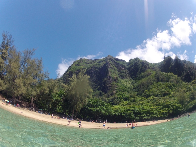
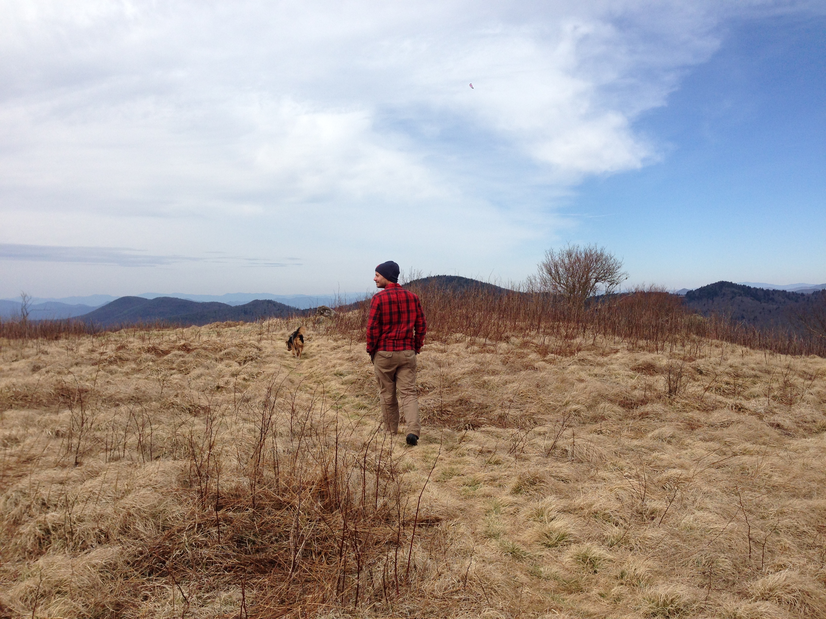
Exploring the meadow

For some reason, we have yet to get motivated to do a winter camping trip. In some ways, it’s silly because we live in the Southeast and spring or fall temperatures at 6,000 feet elevation are often just as cold as anything we would encounter at lower altitudes in the dead of winter. Regardless, we have a mental block about it and just don’t get motivated to gear up and go during the winter. So when spring, in all its wishy washy starts and stops begins to melt and green the landscape, we inevitably feel that the time has come to venture out into nature. This year we had the added pull of friends who invited us to join them. Remembering that semi-spontaneous backpacking is often the only way we end up doing this sort of thing, we immediately accepted the offer and quickly started planning.

On this occasion, we got an amazing recommendation from Bob, a church friend who has spent many years as a scout master and an adventurer at large. We were relaying our customary debate of whether to return to an old, beloved location or explore somewhere new with the risk of disappointment, when he described a place he had nicknamed “the Shire” because of its wild beauty, quiet green paths, and dramatic scenic views. Immediately, we were captivated, and I definitely felt like any place besides the Shire would be a total letdown.

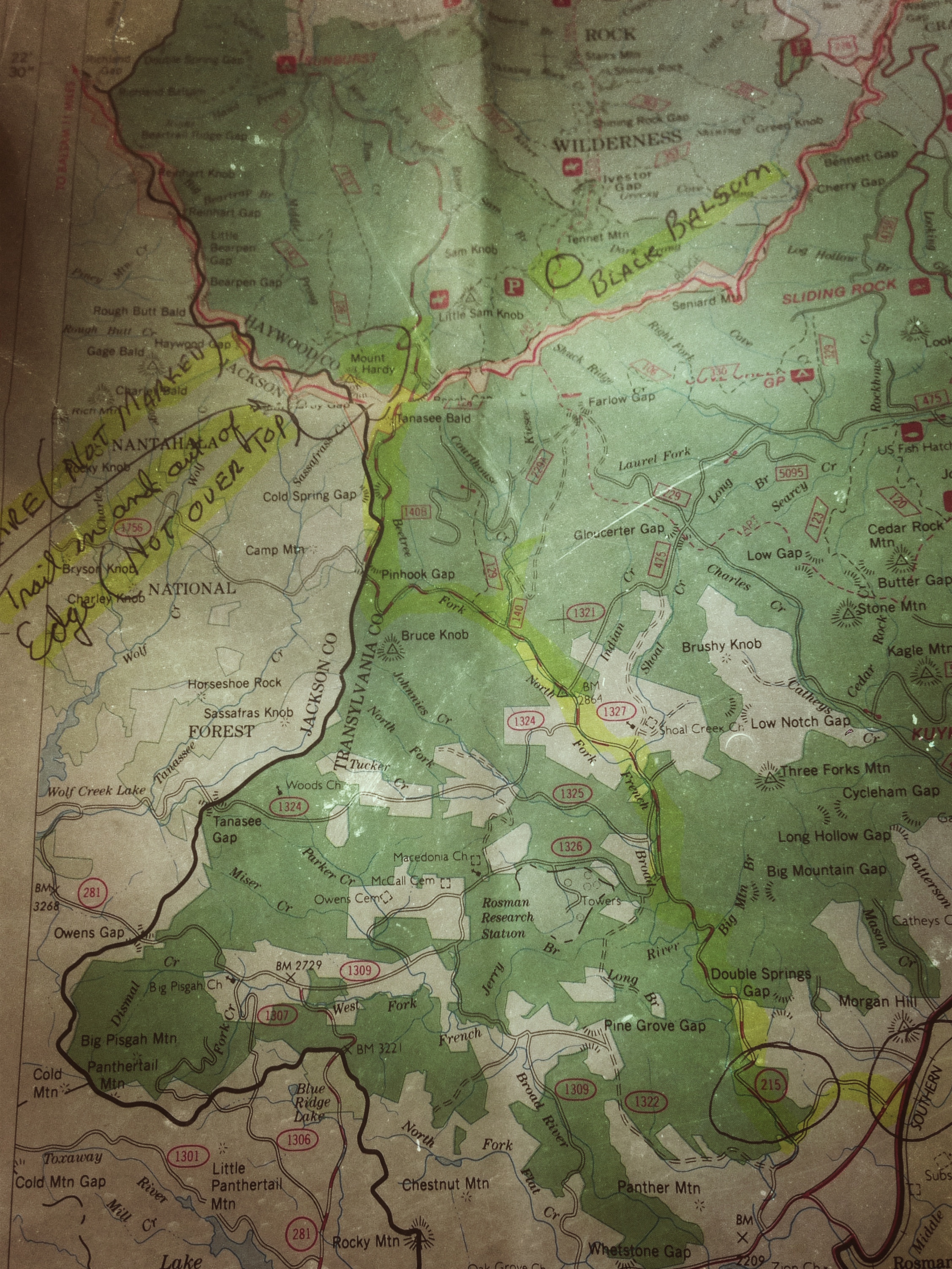
Our friend described where this place was, but with our lack of experience we couldn’t begin to place it. He mentioned something about figuring out more specific details for us, but it was nearing our departure day and I wasn’t sure we would be able to reconnect in time to get the information and make it happen. We were in for a surprise. I don’t think 24 hours passed before my mother-in-law dropped off a map she had received from Bob at a church function. It felt like a treasure map, with its circles and other markings. I poured over it eagerly, and then immediately texted a picture of it to my husband. It was quickly settled that the Shire would be our destination, and looking at the map we found that it was in an area called the Middle Prong Wilderness (not Middle-Earth) near Mount Hardy.

IMG_6366

Our map

We began to research our travel route and look for various hiker accounts of the trail. The intrigue continued as multiple sources described a place of unmarked trails, gorgeous vistas, stream crossings, and many accidental wrong turns. After printing two detailed accounts of the trails we were planning to take into this area, stuffing our bags and car, and loading up on enough food for 3 days of backpacking, we set out on our 1 night trip. (We tend to overpack in hopes that it will make us feel less unprepared to face the wild.)

Without cell phone service, it was a little tricky to connect with our friends, but thankfully our meeting place and timing worked out perfectly. We had no specifics on where to actually set up camp, but we figured we could just start hiking and keep our eyes open. One of the hiker accounts had mentioned a meadow that sounded promising about 4 miles in, so that was our tentative goal.

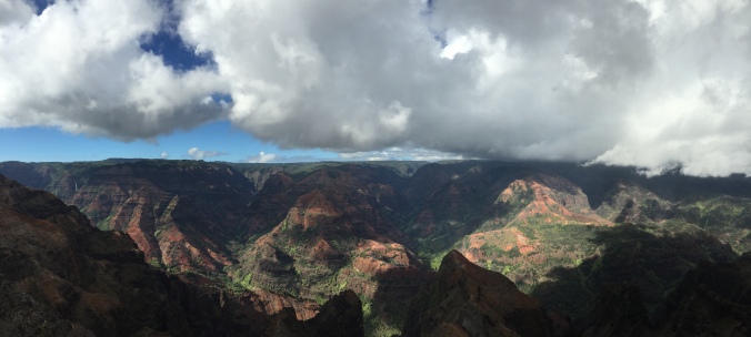
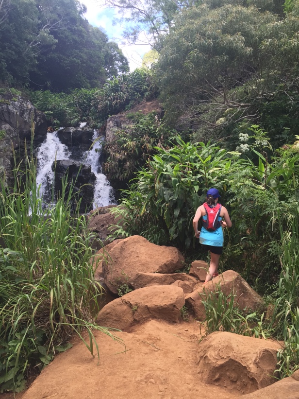
The hike was unbelievable. There were lovely streams, carpets of moss, boulder-sized rocks, and dark higher elevation forest growth that added an air of mystery to the whole scene. As the sun was getting ready to set we finally stumbled upon a meadow. We weren’t even sure we had taken the right turn, but the trees opened up and as we continued to climb we came to a stunning clearing. The view revealed mountain after mountain and a softly setting sun. Along the way, we had not passed other hikers, but scattered across this spot a few pairs of other backpackers were also making camp. We settled in for the night, made dinner, hung our bear bag, and slept as soundly as possible.

IMG_6193

Sunset Summit

Ironically, our lovely spring camping trip ended up being about as cold as any we’ve taken. It cooled off dramatically as soon as the sun began to set, and in the morning it felt even colder. We were so grateful for our nervousness-induced overpacking because it had included some hastily snagged gloves and beanies. Our breakfast was a feast with french pressed coffee, eggs, and summer sausage, but even with that we never quite warmed up until the hike down was almost complete. Nevertheless, we all felt that we had indeed found a treasure with the help of our special map, and we are determined to return as soon as possible for more adventures. This place is breathtaking!

IMG_6136

A cold, tired Zoe dog

Hike or Backpack this trail: This area is not far from Graveyard Fields off of the Blue Ridge Parkway. I’m posting two of the blog posts we looked at because they were very detailed and helpful to us. There are a lot of different ways to explore the Middle Prong Wilderness, but we found this to be a great entry point. http://www.hikewnc.info/besthikes/middle-prong-wilderness/green-knob http://smokyscout.blogspot.com/2012/04/normal-0-false-false-false-en-us-x-none.html

Tips: Always exercise caution when exploring a wilderness area. We found out ahead of time that campfires are not allowed in this region, so that is definitely something to be aware of if you’re camping. This is a decently tough hike, definitely not something you would want to do without water, a map, good footwear, and some careful study beforehand about what to expect. The trails are pretty worn, but it does seem like you could get lost pretty easily since there are no signs. Always take a buddy or let people know where you’re going and when you expect to return.

Keep looking for adventure far and nigh!